Cof Cymru: National Historic Assets of Wales · Wales
59 Bridge Street
Usk, Monmouthshire, Wales
A Grade II listed building in Usk, Monmouthshire, designated on 30 April 2004.
The record
- Designation
- Listed building, Grade II
- Broad class
- Commercial
- Date of designation
- 30 April 2004
- Locality
- Usk
- Town
- Usk
- Community
- Usk
- Unitary authority
- Monmouthshire
- Country
- Wales
- Coordinates
- 51.70213, -2.90557
- Cadw reference
- 82748
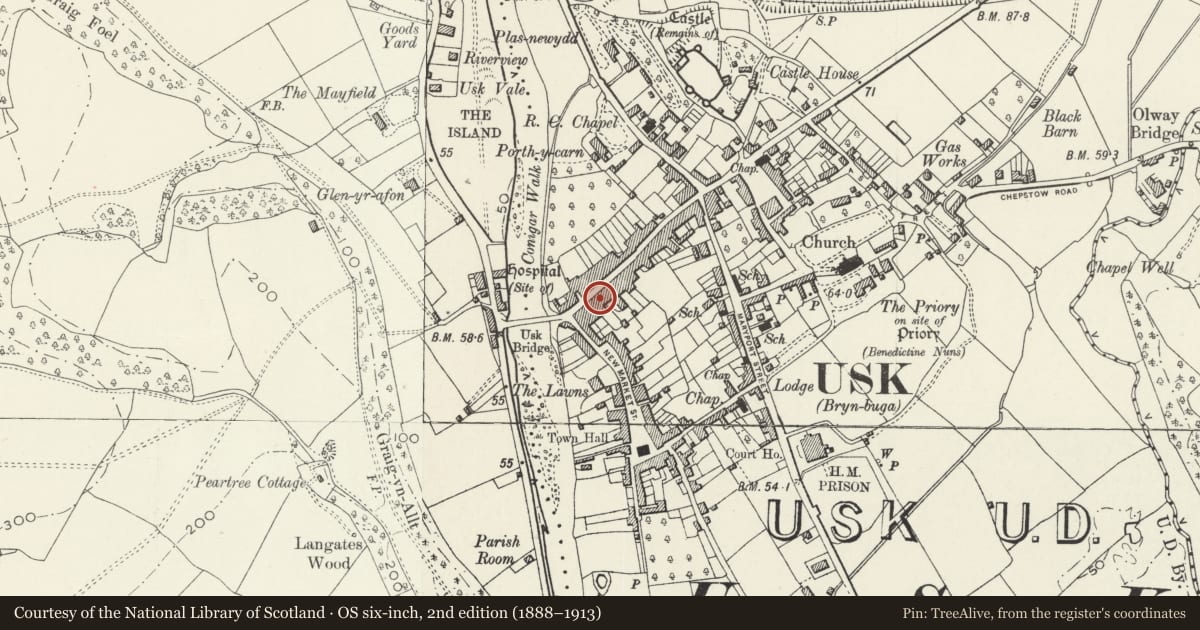
Slide toward Today to fade the historical sheet and see the modern map underneath.
David Rumsey Map Collection, Stanford LibrariesDavid Rumsey Map Collection, Stanford LibrariesDavid Rumsey Map Collection, Stanford LibrariesDavid Rumsey Map Collection, Stanford LibrariesDavid Rumsey Map Collection, Stanford Libraries
5 historical maps cover this location, the earliest the 1636 map "Cornubia : Devonia, Somersetus, Dorcestria, Wiltonia, Glocestria ..." (David Rumsey Map Collection, Stanford Libraries).
Historical maps covering this location
- 1636 · Cornubia : Devonia, Somersetus, Dorcestria, Wiltonia, Glocestria ... (David Rumsey Map Collection, Stanford Libraries)
- 1637 · The fourth table of England. Cornub. Devonia, Somerset etc. (David Rumsey Map Collection, Stanford Libraries)
- 1830 · V.3:11-15:XV.Britisches Reich. A. Kon: England. a. England ab sich: Shire:15-17, 33 (David Rumsey Map Collection, Stanford Libraries)
- 1895 · Sheet 11. Ordnance Survey of England and Wales. (David Rumsey Map Collection, Stanford Libraries)
- 1913 · Sheet 102. Newport. (David Rumsey Map Collection, Stanford Libraries)
Cadw's description
Location
Part of the westernmost range on the S side of Bridge Street, adjacent to the listed Bank.
History
Late Victorian.
Exterior
Tall late Victorian business premises with classicizing detail. Attached at each side, projecting from Bank at left. Roughcast rendered with stucco dressings contrastingly painted; slate roof with tall decoratively rendered corniced stack. Three storeys. Elaborate raised dressings throughout: wide scored pilastered quoins to first floor; paired to second with bracket capitals to overhanging fully bracketed pediment; moulded string-courses, window surrounds with keystones, eared architraves, hoodmoulds and stops and bracketed sills. Three storeys to the main projecting bay with triple round-arched lights to attic and double segmental-arched first floor sashes; narrow side windows to returns. Narrower 3-storey bay set back to right and a lower single storey bay at end right with steep pitched slate roof. Ground floor renewed double shopfront.
Reason for designation
Listed as a well-designed late Victorian business premises. Group value with other listed buildings in Bridge Street.
Nearby in the register
- National Westminster BankCommercialunder 1 mi
- Telephone Call-box outside Nos.26 & 28 Bridge StreetCommunicationsunder 1 mi
- Bridge Street, and attached iron railingsCommercialunder 1 mi
- Bridge Street, rear wingInstitutionalunder 1 mi
Other entries of the same register within about three miles of this one, by straight line.