Cof Cymru: National Historic Assets of Wales · Wales
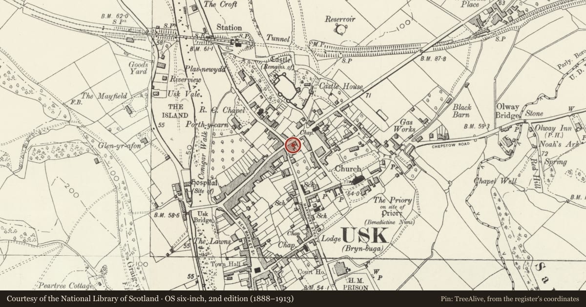
2 Castle Parade
Usk, Monmouthshire, Wales
A Grade II listed building in Usk, Monmouthshire, designated on 30 April 2004.
The record
- Designation
- Listed building, Grade II
- Broad class
- Commercial
- Date of designation
- 30 April 2004
- Locality
- Usk
- Town
- Usk
- Community
- Usk
- Unitary authority
- Monmouthshire
- Country
- Wales
- Coordinates
- 51.70351, -2.90308
- Cadw reference
- 82723
Slide toward Today to fade the historical sheet and see the modern map underneath.
David Rumsey Map Collection, Stanford LibrariesDavid Rumsey Map Collection, Stanford LibrariesDavid Rumsey Map Collection, Stanford LibrariesDavid Rumsey Map Collection, Stanford LibrariesDavid Rumsey Map Collection, Stanford Libraries
5 historical maps cover this location, the earliest the 1636 map "Cornubia : Devonia, Somersetus, Dorcestria, Wiltonia, Glocestria ..." (David Rumsey Map Collection, Stanford Libraries).
Historical maps covering this location
- 1636 · Cornubia : Devonia, Somersetus, Dorcestria, Wiltonia, Glocestria ... (David Rumsey Map Collection, Stanford Libraries)
- 1637 · The fourth table of England. Cornub. Devonia, Somerset etc. (David Rumsey Map Collection, Stanford Libraries)
- 1830 · V.3:11-15:XV.Britisches Reich. A. Kon: England. a. England ab sich: Shire:15-17, 33 (David Rumsey Map Collection, Stanford Libraries)
- 1895 · Sheet 11. Ordnance Survey of England and Wales. (David Rumsey Map Collection, Stanford Libraries)
- 1913 · Sheet 102. Newport. (David Rumsey Map Collection, Stanford Libraries)
Cadw's description
Location
Adjacent to the bank on the corner of Maryport Street, by the main town crossroads.
History
c 1900.
Exterior
Pair of late Victorian shops with accommodation above, attached at each side. Of red and yellow brick; slate roof with twin gables with decorative applied timbering and apex finials, resting on deeply overhanging bracketed boarded eaves; similar brick corniced stacks. Yellow brick quoins, window surrounds, eaves and billet-moulded string course. Three storeys. Each shop has a single window range of cross-framed glazing with decorative squared glazing to upper lights, plain below: tripartite to top floor, canted bay to first floor. Paired plate glass shopfronts with deep fascia with side panels enriched with incised patterns; deep angled sills to the windows and side glazed doorways; plinth.
Reason for designation
Listed as part of the late Victorian business development of the town, retaining strong character, in a dominating position.
Nearby in the register
- Barclays BankCommercialunder 1 mi
- 3 Maryport StreetDomesticunder 1 mi
- 5 Maryport StreetDomesticunder 1 mi
- 7 Maryport StreetDomesticunder 1 mi
Other entries of the same register within about three miles of this one, by straight line.