Cof Cymru: National Historic Assets of Wales · Wales
The Cottage
Penllyn, Vale of Glamorgan, Wales
A Grade II listed building in Llansannor, Cowbridge, Penllyn, Vale of Glamorgan, designated on 30 April 2004.
The record
- Designation
- Listed building, Grade II
- Broad class
- Domestic
- Date of designation
- 30 April 2004
- Locality
- Llansannor
- Town
- Cowbridge
- Community
- Penllyn
- Unitary authority
- Vale of Glamorgan
- Country
- Wales
- Coordinates
- 51.48788, -3.45111
- Cadw reference
- 82691
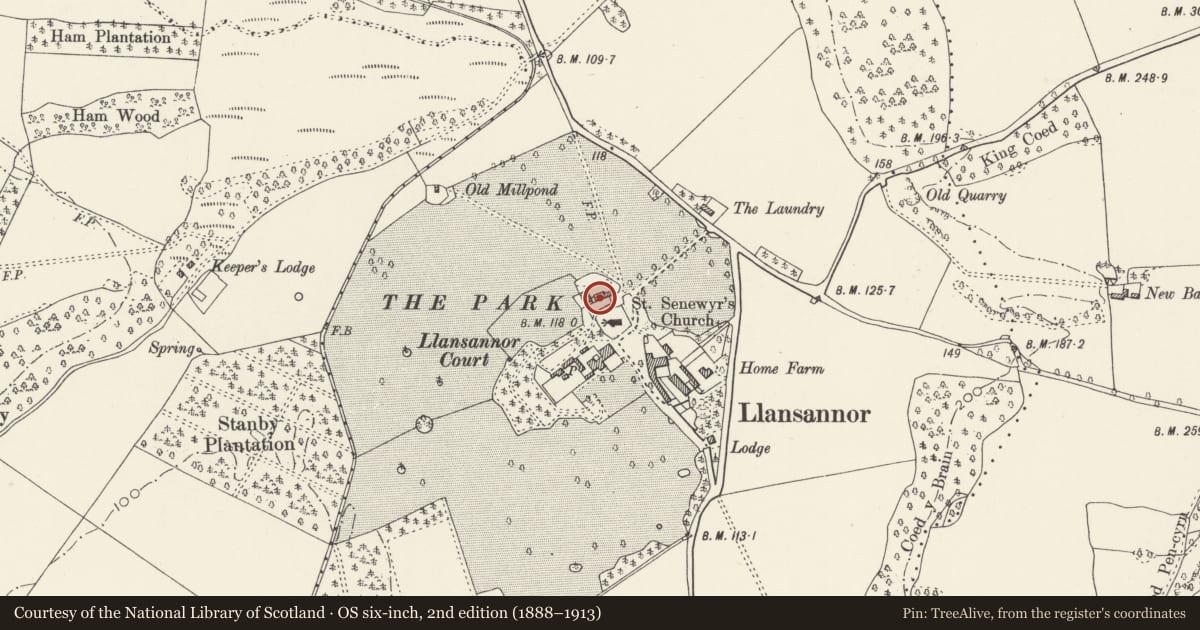
Slide toward Today to fade the historical sheet and see the modern map underneath.
David Rumsey Map Collection, Stanford LibrariesDavid Rumsey Map Collection, Stanford LibrariesDavid Rumsey Map Collection, Stanford LibrariesDavid Rumsey Map Collection, Stanford LibrariesDavid Rumsey Map Collection, Stanford Libraries
5 historical maps cover this location, the earliest the 1636 map "Cornubia : Devonia, Somersetus, Dorcestria, Wiltonia, Glocestria ..." (David Rumsey Map Collection, Stanford Libraries).
Historical maps covering this location
- 1636 · Cornubia : Devonia, Somersetus, Dorcestria, Wiltonia, Glocestria ... (David Rumsey Map Collection, Stanford Libraries)
- 1637 · The fourth table of England. Cornub. Devonia, Somerset etc. (David Rumsey Map Collection, Stanford Libraries)
- 1865 · England and Wales. England No. 6. (David Rumsey Map Collection, Stanford Libraries)
- 1897 · 262 Pontypridd (Hills) (David Rumsey Map Collection, Stanford Libraries)
- 1897 · 262 Pontypridd (Outline) (David Rumsey Map Collection, Stanford Libraries)
Cadw's description
Location
About 20m north of Church of St. Senwyr.
History
A probably early C18 house, though the unevenly spaced windows could suggest the inclusion of earlier fabric. All the stonework appears the same, however, and the generous floor heights and the gable chimneys point to the C18. The house appears on the 1845 tithe map.
Exterior
Built of local limestone random rubble with the remains of lime render, Welsh slate roof. Single depth two storey range with rear outshut. Five bays with unevenly spaced windows. Two set widely apart to the left, 6 over 6 pane sashes in elliptical heads, gabled porch in the second bay. Three closely together to the right, very heavily shrouded in wisteria but with 3 over 3 pane sashes on the upper floor. Moderate pitch roof with stone gable stacks. Rear elevation with some alteration.
Interior
Interior not seen at resurvey.
Reason for designation
Included for its special interest as an early C18 house with a good facade and group value with the Church of St. Senwyr.
Nearby in the register
- Church of St. SenwyrReligious, Ritual and Funeraryunder 1 mi
- Cross in Churchyard of Church of St. SenwyrReligious, Ritual and Funeraryunder 1 mi
- Llansannor CourtDomesticunder 1 mi
- West Wing of Llansannor Court (aka Court Cottage)Domesticunder 1 mi
Other entries of the same register within about three miles of this one, by straight line.