Cof Cymru: National Historic Assets of Wales · Wales
Dovecote at Great Nash
Llangwm, Pembrokeshire, Wales
A Grade II listed building in Llangwm, Haverfordwest, Pembrokeshire, designated on 21 April 2004.
The record
- Designation
- Listed building, Grade II
- Broad class
- Agriculture and Subsistence
- Date of designation
- 21 April 2004
- Locality
- Llangwm
- Town
- Haverfordwest
- Community
- Llangwm
- Unitary authority
- Pembrokeshire
- Country
- Wales
- Coordinates
- 51.75339, -4.93333
- Cadw reference
- 82673
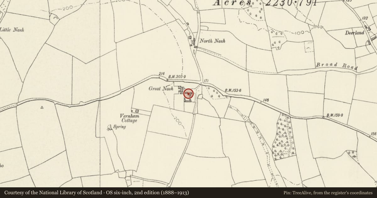
Slide toward Today to fade the historical sheet and see the modern map underneath.
David Rumsey Map Collection, Stanford LibrariesDavid Rumsey Map Collection, Stanford LibrariesDavid Rumsey Map Collection, Stanford LibrariesDavid Rumsey Map Collection, Stanford LibrariesDavid Rumsey Map Collection, Stanford Libraries
5 historical maps cover this location, the earliest the 1636 map "Cornubia : Devonia, Somersetus, Dorcestria, Wiltonia, Glocestria ..." (David Rumsey Map Collection, Stanford Libraries).
Historical maps covering this location
- 1636 · Cornubia : Devonia, Somersetus, Dorcestria, Wiltonia, Glocestria ... (David Rumsey Map Collection, Stanford Libraries)
- 1830 · V.3:11-15:XV. Britisches Reich. A. Kon: England. b. Frstenthum Wales: Shire: 37-40 (David Rumsey Map Collection, Stanford Libraries)
- 1891 · Sheet 10. Ordnance Survey of England and Wales. . (David Rumsey Map Collection, Stanford Libraries)
- 1898 · 228 Haverfordwest (Hills) (David Rumsey Map Collection, Stanford Libraries)
- 1901 · Sheet 13. (David Rumsey Map Collection, Stanford Libraries)
Cadw's description
Location
Among agricultural buildings on the S side of the drive to Great Nash.
History
Dovecote, uncertain date possibly late medieval or C16, similar to the one at Rosemarket. Great Nash was an important gentry house, replaced by the present farmhouse in the C18. Recorded as occupied by the Nash family C15-C16, the heiress marrying Alban Philipps, a younger son of Picton. The Philipps were followed before 1670 by one of the Corbetts of Ynysmaengwyn, Merioneths. The house then had 6 hearths. Dorothy Corbett married a son of Sir Hugh Owen of Orielton before 1704. Their son Wyrriott Owen died 1773, his son Hugh died 1809. In 1811 when the house was ruined and the woods cut down, Fenton described the house as having been fashionable for its date, a sort of cube, i.e. possibly later C17.
Exterior
Dovecote, rubble stone circular with remnants of roughcast. Domed roof in 3 steps with stone shelf courses between, presumably with circular top entry. No opening except for a small S entry, apparently broken through. Said to have had a door on the E now blocked.
Interior
Interior inaccessible, but lined with stone nesting boxes said to number about 200.
Reason for designation
Included as a large and impressive late medieval or C16 dovecote.
Nearby in the register
- Round Barrow 300m NW of TallyhoRound Barrowunder 1 mi
- Milepost at Trooper's InnTransportunder 1 mi
- Ashdale HouseDomesticunder 1 mi
- Hook QuayQuayunder 1 mi
Other entries of the same register within about three miles of this one, by straight line.