Cof Cymru: National Historic Assets of Wales · Wales
Gatepiers and gates to forecourt at Trawsgoed House
Trawsgoed, Ceredigion, Wales
A Grade II listed building in Trawsgoed, Aberystwyth, Ceredigion, designated on 31 March 2004.
The record
- Designation
- Listed building, Grade II
- Broad class
- Domestic
- Date of designation
- 31 March 2004
- Locality
- Trawsgoed
- Town
- Aberystwyth
- Community
- Trawsgoed
- Unitary authority
- Ceredigion
- Country
- Wales
- Coordinates
- 52.33986, -3.95157
- Cadw reference
- 82653
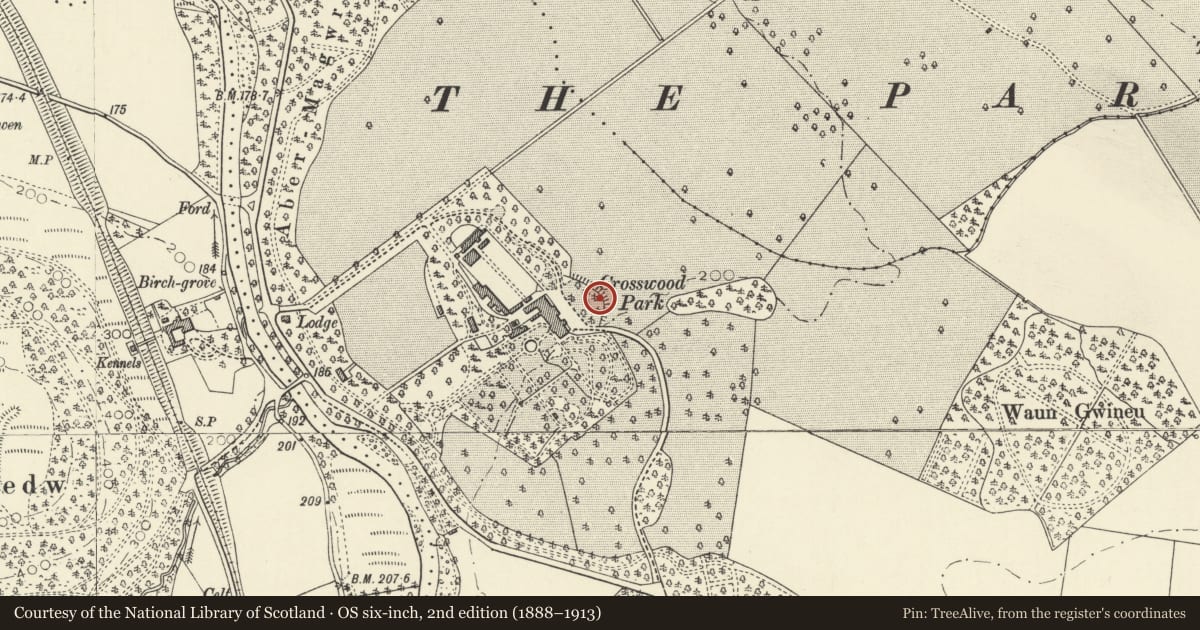
Slide toward Today to fade the historical sheet and see the modern map underneath.
David Rumsey Map Collection, Stanford LibrariesDavid Rumsey Map Collection, Stanford LibrariesDavid Rumsey Map Collection, Stanford LibrariesDavid Rumsey Map Collection, Stanford LibrariesDavid Rumsey Map Collection, Stanford Libraries
5 historical maps cover this location, the earliest the 1830 map "V.3:11-15:XV. Britisches Reich. A. Kon: England. b. Frstenthum Wales: Shire: 37-40" (David Rumsey Map Collection, Stanford Libraries).
Historical maps covering this location
- 1830 · V.3:11-15:XV. Britisches Reich. A. Kon: England. b. Frstenthum Wales: Shire: 37-40 (David Rumsey Map Collection, Stanford Libraries)
- 1883 · Watershed map England, Wales 3. (David Rumsey Map Collection, Stanford Libraries)
- 1896 · Sheet 7. Ordnance Survey of England and Wales. (David Rumsey Map Collection, Stanford Libraries)
- 1899 · 178 Llanilar (Hills) (David Rumsey Map Collection, Stanford Libraries)
- 1901 · Sheet 14. (David Rumsey Map Collection, Stanford Libraries)
Cadw's description
Location
Situated opposite NE entrance front, in line with front door.
History
Earlier C20 iron gates and stone piers made for the 7th Earl of Lisburne to enclose the forecourt, shown under construction in a photograph of 1927. The gates are ornamental, giving access only to a ha-ha beyond.
Exterior
Pair of cast-iron gates between rubble stone square piers with stepped caps and tall ashlar urn finials flanked by low rubble walls ramped up to piers. Gates each have a band of circles at foot and at level of lock, narrow ovals below lock rail and spearhead rails above with opposed curves between, above lock rail and below top rail. Urns are turned with ball finials.
Reason for designation
Included as a good garden feature, marking the boundary between the forecourt and the park, of group value with the mansion.
Nearby in the register
- Trawsgoed HouseDomesticunder 1 mi
- Ornamental fountain and basin at Trawsgoed HouseGardens, Parks and Urban Spacesunder 1 mi
- Terrace wall and steps at foot of lawn to SW of Trawsgoed HouseDomesticunder 1 mi
- The Old DairyDomesticunder 1 mi
Other entries of the same register within about three miles of this one, by straight line.