Cof Cymru: National Historic Assets of Wales · Wales
Haroldston Cottage
Merlin's Bridge, Pembrokeshire, Wales
A Grade II listed building in Haroldston, Haverfordwest, Merlin's Bridge, Pembrokeshire, designated on 11 March 2004.
The record
- Designation
- Listed building, Grade II
- Broad class
- Domestic
- Date of designation
- 11 March 2004
- Locality
- Haroldston
- Town
- Haverfordwest
- Community
- Merlin's Bridge
- Unitary authority
- Pembrokeshire
- Country
- Wales
- Coordinates
- 51.79434, -4.96073
- Cadw reference
- 82632
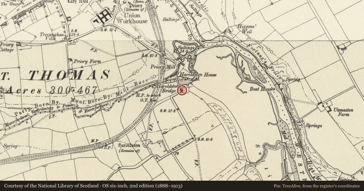
Slide toward Today to fade the historical sheet and see the modern map underneath.
David Rumsey Map Collection, Stanford LibrariesDavid Rumsey Map Collection, Stanford LibrariesDavid Rumsey Map Collection, Stanford LibrariesDavid Rumsey Map Collection, Stanford LibrariesDavid Rumsey Map Collection, Stanford Libraries
5 historical maps cover this location, the earliest the 1608 map "(13) Cambriae Typus." (David Rumsey Map Collection, Stanford Libraries).
Historical maps covering this location
- 1608 · (13) Cambriae Typus. (David Rumsey Map Collection, Stanford Libraries)
- 1636 · Cornubia : Devonia, Somersetus, Dorcestria, Wiltonia, Glocestria ... (David Rumsey Map Collection, Stanford Libraries)
- 1891 · Sheet 10. Ordnance Survey of England and Wales. . (David Rumsey Map Collection, Stanford Libraries)
- 1898 · 228 Haverfordwest (Hills) (David Rumsey Map Collection, Stanford Libraries)
- 1901 · Sheet 13. (David Rumsey Map Collection, Stanford Libraries)
Cadw's description
Location
On a bend in a minor road some 60m S of Haroldston Bridge.
History
Mid C19 cottage overlooking Haroldston Bridge, exceptionally well-built for a cottage, with minimal Tudor detail.
Exterior
Cottage, squared brown sandstone with slate roof overhanging at left gable with bargeboards and cut stone end stacks with dripstones and capstones. Single storey with loft, double fronted with 9-pane hornless sash each side of centre board door, all three with cut sandstone square hoodmoulds over cut stone voussoirs. Painted slate sills. Left end wall, facing bridge, is similar stone with small 4-pane loft light under hoodmould, ground floor right narrow 8-pane sash with hoodmould and left lean-to. Rendered right hand end wall with loft light. Rear outshut. Forecourt enclosed by rubble walls with stepped end-on stone coping, square sandstone gatepiers with painted pyramid caps and 3 stone steps up.
Interior
Not inspected.
Nearby in the register
- Haroldston Bridge (partly in Haverfordwest community)Transportunder 1 mi
- Haroldstone Bridge (partly in Merlins Bridge community)Transportunder 1 mi
- Haroldston House and GardensHouse (domestic)under 1 mi
- Higgon's WellReligious, Ritual and Funeraryunder 1 mi
Other entries of the same register within about three miles of this one, by straight line.