Cof Cymru: National Historic Assets of Wales · Wales
No. 1 Glandwr (cottage at left), with walled and railed forecourt
Llansantffraid, Powys, Wales
A Grade II listed building in Llansantffraid-ym-Mechain village, Llansantffraid, Powys, designated on 2 March 2004.
The record
- Designation
- Listed building, Grade II
- Broad class
- Domestic
- Date of designation
- 2 March 2004
- Locality
- Llansantffraid-ym-Mechain village
- Community
- Llansantffraid
- Unitary authority
- Powys
- Country
- Wales
- Coordinates
- 52.77621, -3.14813
- Cadw reference
- 82567
Slide toward Today to fade the historical sheet and see the modern map underneath.
David Rumsey Map Collection, Stanford LibrariesDavid Rumsey Map Collection, Stanford LibrariesDavid Rumsey Map Collection, Stanford LibrariesDavid Rumsey Map Collection, Stanford LibrariesLlyfrgell Genedlaethol Cymru – The National Library of Wales
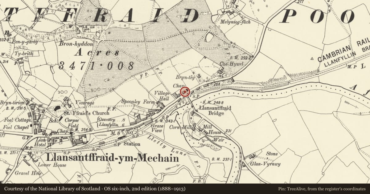
5 historical maps cover this location, the earliest the 1795 map "To Sir Watkin Williams-Wynn Bart ... the map of the six counties of North Wales is most humbly inscribed by his obedient humble servant" (Llyfrgell Genedlaethol Cymru – The National Library of Wales).
Historical maps covering this location
- 1795 · To Sir Watkin Williams-Wynn Bart ... the map of the six counties of North Wales is most… (Llyfrgell Genedlaethol Cymru – The National Library of Wales)
- 1883 · Watershed map England, Wales 3. (David Rumsey Map Collection, Stanford Libraries)
- 1897 · 137 Oswestry (Hills) (David Rumsey Map Collection, Stanford Libraries)
- 1901 · Sheet 9 and 10. (David Rumsey Map Collection, Stanford Libraries)
- 1916 · Sheet 60. Shrewsbury. (David Rumsey Map Collection, Stanford Libraries)
Cadw's description
Location
At north side of the main street of the village, opposite Llansantffraid Bridge.
History
A pair of similar but evidently not contemporary cottages; the cottage at left probably predates that at right. The cottage at left carries the inscription 'R O / MDCCCXLVII'. The site was earlier recorded (in 1838) as owned and occupied by a house and school owned and occupied by W Richard Owen, possibly the same person as R O.
Exterior
Window openings with cambered arches in common brick and with stone sills. Hornless 16-pane sash windows. Four-panel semi-glazed door. Brick and stone front wall to small forecourt, with iron railings and centre gate.
Reason for designation
An early Victorian cottage of sophisticated design, with a later and less carefully detailed pair; both buildings of some character, well preserved.
Nearby in the register
- No. 2 Glandwr (cottage at right), with walled forecourtDomesticunder 1 mi
- Bridge House, with walled and railed forecourtCommercialunder 1 mi
- Llansantffraid BridgeTransportunder 1 mi
- Sun HotelCommercialunder 1 mi
Other entries of the same register within about three miles of this one, by straight line.