Cof Cymru: National Historic Assets of Wales · Wales
Cast-iron milepost at Queen's Oak
Llansantffraid, Powys, Wales
A Grade II listed building in Llansantffraid-ym-Mechain village, Llansantffraid, Powys, designated on 2 March 2004.
The record
- Designation
- Listed building, Grade II
- Broad class
- Transport
- Date of designation
- 2 March 2004
- Locality
- Llansantffraid-ym-Mechain village
- Community
- Llansantffraid
- Unitary authority
- Powys
- Country
- Wales
- Coordinates
- 52.77456, -3.15351
- Cadw reference
- 82554
Slide toward Today to fade the historical sheet and see the modern map underneath.
David Rumsey Map Collection, Stanford LibrariesDavid Rumsey Map Collection, Stanford LibrariesDavid Rumsey Map Collection, Stanford LibrariesDavid Rumsey Map Collection, Stanford LibrariesLlyfrgell Genedlaethol Cymru – The National Library of Wales
5 historical maps cover this location, the earliest the 1795 map "To Sir Watkin Williams-Wynn Bart ... the map of the six counties of North Wales is most humbly inscribed by his obedient humble servant" (Llyfrgell Genedlaethol Cymru – The National Library of Wales).
Historical maps covering this location
- 1795 · To Sir Watkin Williams-Wynn Bart ... the map of the six counties of North Wales is most… (Llyfrgell Genedlaethol Cymru – The National Library of Wales)
- 1883 · Watershed map England, Wales 3. (David Rumsey Map Collection, Stanford Libraries)
- 1897 · 137 Oswestry (Hills) (David Rumsey Map Collection, Stanford Libraries)
- 1901 · Sheet 9 and 10. (David Rumsey Map Collection, Stanford Libraries)
- 1916 · Sheet 60. Shrewsbury. (David Rumsey Map Collection, Stanford Libraries)
Cadw's description
Location
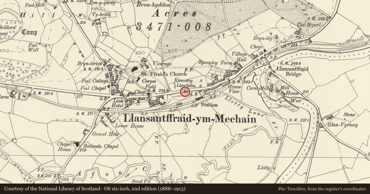
At south side of the main street of the village, almost oppostite the War Memorial.
History
Probably late C19 or early C20; Turner Brothers were noted in a trade directory in Newtown in 1903.
Exterior
A cast-iron milepost rounded at top and angled at front. At the head is 'Shrewsbury 19 M'; at left 'Llanfyllin 6 M' and at right 'Oswestry 8 M', in each case with an arrow. The foundry mark 'Turner Bros, Newtown' is faintly impressed. The post is painted white with the raised lettering in black.
Reason for designation
A late C19 or early C20 cast iron milepost, a relic of the era when former turnpikes were under Local Authority management.
Nearby in the register
- No. 1, Victoria Terrace, with walled and railed forecourtDomesticunder 1 mi
- No. 2, Victoria Terrace, with walled and railed forecourtDomesticunder 1 mi
- No. 3, Victoria Terrace, with walled and railed forecourtDomesticunder 1 mi
- No. 4, Victoria Terrace, with walled and railed forecourtDomesticunder 1 mi
Other entries of the same register within about three miles of this one, by straight line.