Cof Cymru: National Historic Assets of Wales · Wales
Outbuilding at Berth-ddu
Trawsfynydd, Gwynedd, Wales
A Grade II listed building in Nant Bryn Llefrith, Trawsfynydd, Gwynedd, designated on 27 February 2004.
The record
- Designation
- Listed building, Grade II
- Broad class
- Agriculture and Subsistence
- Date of designation
- 27 February 2004
- Locality
- Nant Bryn Llefrith
- Community
- Trawsfynydd
- Unitary authority
- Gwynedd
- Country
- Wales
- Coordinates
- 52.88807, -3.91844
- Cadw reference
- 82540
Slide toward Today to fade the historical sheet and see the modern map underneath.
David Rumsey Map Collection, Stanford LibrariesDavid Rumsey Map Collection, Stanford LibrariesDavid Rumsey Map Collection, Stanford LibrariesLlyfrgell Genedlaethol Cymru – The National Library of WalesDavid Rumsey Map Collection, Stanford Libraries
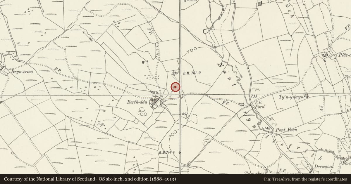
5 historical maps cover this location, the earliest the 1795 map "To Sir Watkin Williams-Wynn Bart ... the map of the six counties of North Wales is most humbly inscribed by his obedient humble servant" (Llyfrgell Genedlaethol Cymru – The National Library of Wales).
Historical maps covering this location
- 1795 · To Sir Watkin Williams-Wynn Bart ... the map of the six counties of North Wales is most… (Llyfrgell Genedlaethol Cymru – The National Library of Wales)
- 1883 · Watershed map England, Wales 3. (David Rumsey Map Collection, Stanford Libraries)
- 1896 · Sheet 7. Ordnance Survey of England and Wales. (David Rumsey Map Collection, Stanford Libraries)
- 1899 · 135 Harlech (Hills) (David Rumsey Map Collection, Stanford Libraries)
- 1901 · Sheet 9 and 10. (David Rumsey Map Collection, Stanford Libraries)
Cadw's description
Location
Between the house and the detached cow-house and haybarn, close to the west side of the A470, and built against sloping ground.
History
Apparently a small field cowhouse, perhaps preceding the larger structure to its north. No direct dating evidence, but probably C18. At the time of the Tithe survey if 1849, there were two farmsteads at Berth-ddu - this building may be a survival from this period before a larger holding was created.
Exterior
Small field cow-house. Built against the slope such that its gable end pitching door is accessible from the higher ground level. Mortared rubble stone with close-eaved slate roof. Doorway in south wall, pitching door in east gable end.
Reason for designation
Forms part of a group of dispersed out-buildings at Berth-ddu which clearly illustrate the organisation of animal husbandry typical of upland agriculture. A small-scale but characteristic example of its building type.
Nearby in the register
- Hayban and cowhouse at Berth-dduAgriculture and Subsistenceunder 1 mi
- Berth-dduNo class recordedunder 1 mi
- Milestone by Bryn LlefrithTransportunder 1 mi
- Milepost by Fron-oleuTransportunder 1 mi
Other entries of the same register within about three miles of this one, by straight line.