Cof Cymru: National Historic Assets of Wales · Wales
Haystone Bridge (partly in Llanstadwell community)
Rosemarket, Pembrokeshire, Wales
A Grade II listed building in Haystone Bridge, Haverfordwest, Rosemarket, Pembrokeshire, designated on 25 February 2004.
The record
- Designation
- Listed building, Grade II
- Broad class
- Transport
- Date of designation
- 25 February 2004
- Locality
- Haystone Bridge
- Town
- Haverfordwest
- Community
- Rosemarket
- Unitary authority
- Pembrokeshire
- Country
- Wales
- Coordinates
- 51.73940, -4.99249
- Cadw reference
- 82524
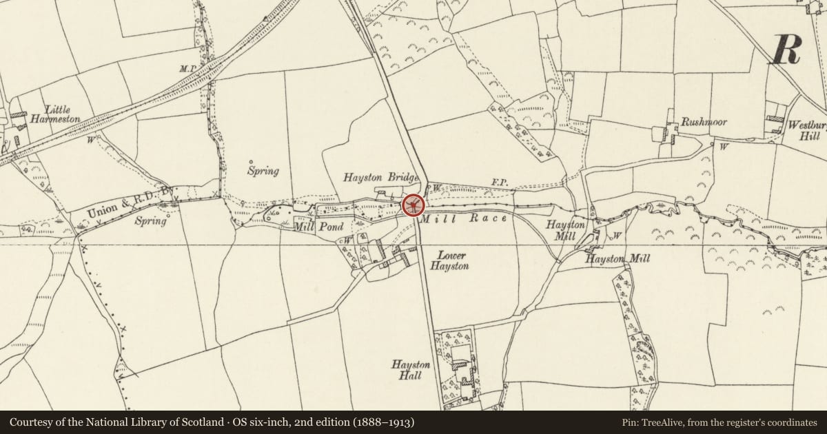
Slide toward Today to fade the historical sheet and see the modern map underneath.
David Rumsey Map Collection, Stanford LibrariesDavid Rumsey Map Collection, Stanford LibrariesDavid Rumsey Map Collection, Stanford LibrariesDavid Rumsey Map Collection, Stanford LibrariesDavid Rumsey Map Collection, Stanford Libraries
5 historical maps cover this location, the earliest the 1608 map "(13) Cambriae Typus." (David Rumsey Map Collection, Stanford Libraries).
Historical maps covering this location
- 1608 · (13) Cambriae Typus. (David Rumsey Map Collection, Stanford Libraries)
- 1636 · Cornubia : Devonia, Somersetus, Dorcestria, Wiltonia, Glocestria ... (David Rumsey Map Collection, Stanford Libraries)
- 1891 · Sheet 10. Ordnance Survey of England and Wales. . (David Rumsey Map Collection, Stanford Libraries)
- 1898 · 228 Haverfordwest (Hills) (David Rumsey Map Collection, Stanford Libraries)
- 1901 · Sheet 13. (David Rumsey Map Collection, Stanford Libraries)
Cadw's description
Location
On the W side of and now bypassed by the A477 some 1.5km S of Johnston.
History
Road bridge over a stream, possibly dated 1799. Bridge is bypassed by present A477 road.
Exterior
Road bridge over stream, rubble stone with small semi-circular arch with stone voussoirs and arch ring. Rubble parapets without differentiation from main bridge. Downstream arch has raised keystone with eroded date, possibly 1799.
Reason for designation
Included for its historic interest as a road bridge with relatively early date.
Nearby in the register
- Hayston Bridge (partly in Rosemarket community)Transportunder 1 mi
- Hayston HallDomesticunder 1 mi
- Lofted outbuilding at Hayston HallDomesticunder 1 mi
- Courtyard of outbuildings at Hayston HallAgriculture and Subsistenceunder 1 mi
Other entries of the same register within about three miles of this one, by straight line.