Cof Cymru: National Historic Assets of Wales · Wales
Dovecote at Nanteos
Llanfarian, Ceredigion, Wales
A Grade II listed building in Rhydyfelin, Aberystwyth, Llanfarian, Ceredigion, designated on 24 February 2004.
The record
- Designation
- Listed building, Grade II
- Broad class
- Agriculture and Subsistence
- Date of designation
- 24 February 2004
- Locality
- Rhydyfelin
- Town
- Aberystwyth
- Community
- Llanfarian
- Unitary authority
- Ceredigion
- Country
- Wales
- Coordinates
- 52.38857, -4.02874
- Cadw reference
- 82514
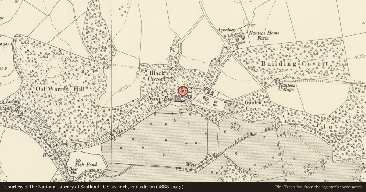
Slide toward Today to fade the historical sheet and see the modern map underneath.
David Rumsey Map Collection, Stanford LibrariesDavid Rumsey Map Collection, Stanford LibrariesDavid Rumsey Map Collection, Stanford LibrariesDavid Rumsey Map Collection, Stanford LibrariesDavid Rumsey Map Collection, Stanford Libraries
5 historical maps cover this location, the earliest the 1830 map "V.3:11-15:XV. Britisches Reich. A. Kon: England. b. Frstenthum Wales: Shire: 37-40" (David Rumsey Map Collection, Stanford Libraries).
Historical maps covering this location
- 1830 · V.3:11-15:XV. Britisches Reich. A. Kon: England. b. Frstenthum Wales: Shire: 37-40 (David Rumsey Map Collection, Stanford Libraries)
- 1883 · Watershed map England, Wales 3. (David Rumsey Map Collection, Stanford Libraries)
- 1896 · Sheet 7. Ordnance Survey of England and Wales. (David Rumsey Map Collection, Stanford Libraries)
- 1899 · 178 Llanilar (Hills) (David Rumsey Map Collection, Stanford Libraries)
- 1901 · Sheet 14. (David Rumsey Map Collection, Stanford Libraries)
Cadw's description
Location
Situated immediately W of the stable block behind the mansion at Nanteos.
History
Dovecote possibly of 1816, possibly of c1830. The dovecote on 1819 estate map was E of old stables, possibly demolished for the new ones. Marked on estate map of c1830-35. In May 1816 plans for a Dove House were drawn by a local architect for a fee of £1, and Morris Jones, mason, conducted work on a 'pigeon house' in July 1816. There are references to an earlier pigeon house in 1795. The structure is known from photographs to have had a shallow-domed slate roof in 3 tiers.
Exterior
Circular pigeon roost tower in coursed rubble, formerly with a domed slate roof with 2 steps, now collapsed. Two storeys externally, with opening to E, formerly door, with brick voussoirs to flat head and flat-headed opening above possibly originally with brick head, now lost.
Interior
Lined in brick with bands of square dove-holes above projecting shelves, also in red brick.
Reason for designation
Included despite condition as a surviving estate dovecote, and for group value with the adjoining buildings.
Nearby in the register
- Stable court at Nanteos, including attached outbuilding to SNo class recordedunder 1 mi
- Retaining wall to S and W of the Dairy at NanteosNo class recordedunder 1 mi
- NanteosDomesticunder 1 mi
- Wall running E of NanteosNo class recordedunder 1 mi
Other entries of the same register within about three miles of this one, by straight line.