Cof Cymru: National Historic Assets of Wales · Wales
Crugiau Lodge
Llanfarian, Ceredigion, Wales
A Grade II listed building in Rhydyfelin, Aberystwyth, Llanfarian, Ceredigion, designated on 24 February 2004.
The record
- Designation
- Listed building, Grade II
- Broad class
- No class recorded
- Date of designation
- 24 February 2004
- Locality
- Rhydyfelin
- Town
- Aberystwyth
- Community
- Llanfarian
- Unitary authority
- Ceredigion
- Country
- Wales
- Coordinates
- 52.39509, -4.06982
- Cadw reference
- 82494
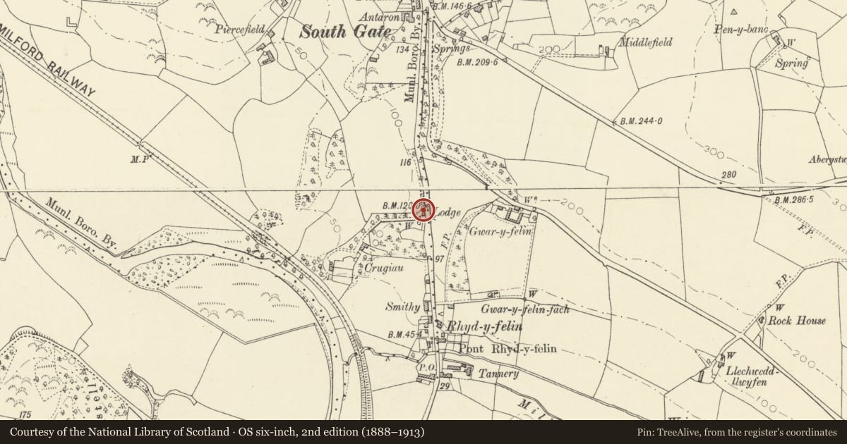
Slide toward Today to fade the historical sheet and see the modern map underneath.
David Rumsey Map Collection, Stanford LibrariesDavid Rumsey Map Collection, Stanford LibrariesDavid Rumsey Map Collection, Stanford LibrariesDavid Rumsey Map Collection, Stanford LibrariesDavid Rumsey Map Collection, Stanford Libraries
5 historical maps cover this location, the earliest the 1830 map "V.3:11-15:XV. Britisches Reich. A. Kon: England. b. Frstenthum Wales: Shire: 37-40" (David Rumsey Map Collection, Stanford Libraries).
Historical maps covering this location
- 1830 · V.3:11-15:XV. Britisches Reich. A. Kon: England. b. Frstenthum Wales: Shire: 37-40 (David Rumsey Map Collection, Stanford Libraries)
- 1883 · Watershed map England, Wales 3. (David Rumsey Map Collection, Stanford Libraries)
- 1896 · Sheet 7. Ordnance Survey of England and Wales. (David Rumsey Map Collection, Stanford Libraries)
- 1899 · 178 Llanilar (Hills) (David Rumsey Map Collection, Stanford Libraries)
- 1901 · Sheet 14. (David Rumsey Map Collection, Stanford Libraries)
Cadw's description
Location
Situated on the W side of the A487, immediately N of a small wooded area to the N of Rhydyfelin.
History
Entrance lodge to Crugiau, probably early C19, perhaps for Captain David Davies owner of Crugiau in 1830 and 1845. Marked on 1845 Tithe Map.
Exterior
Small single storey early C19 square-plan lodge in whitewashed rubble with pyramidal hipped slate roof, flat eaves and large whitewashed rubble square stack on N slope. Single ogee-headed window facing road with small-paned timber casement, Gothic glazing bars in top light, stone sill and plain reveals. N wall to drive is windowless, with small flat-headed C20 half-glazed timber door set to left, plain reveals. Extended to rear in C20.
Interior
Not inspected at time of survey.
Reason for designation
Included as a good small late Georgian lodge of group value with Crugiau.
Nearby in the register
- Wall and gate piers at Crugiau LodgeNo class recordedunder 1 mi
- CrugiauDomesticunder 1 mi
- Ty'n y LonDomesticunder 1 mi
- Garden wall, gates and railings at Ty'n y LonDomesticunder 1 mi
Other entries of the same register within about three miles of this one, by straight line.