Cof Cymru: National Historic Assets of Wales · Wales
Cartshed at Glascrug
Llanfarian, Ceredigion, Wales
A Grade II listed building in Llanbadarn Fawr, Aberystwyth, Llanfarian, Ceredigion, designated on 24 February 2004.
The record
- Designation
- Listed building, Grade II
- Broad class
- Agriculture and Subsistence
- Date of designation
- 24 February 2004
- Locality
- Llanbadarn Fawr
- Town
- Aberystwyth
- Community
- Llanfarian
- Unitary authority
- Ceredigion
- Country
- Wales
- Coordinates
- 52.40548, -4.02626
- Cadw reference
- 82492
Slide toward Today to fade the historical sheet and see the modern map underneath.
David Rumsey Map Collection, Stanford LibrariesDavid Rumsey Map Collection, Stanford LibrariesDavid Rumsey Map Collection, Stanford LibrariesDavid Rumsey Map Collection, Stanford LibrariesDavid Rumsey Map Collection, Stanford Libraries
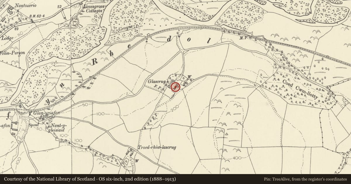
5 historical maps cover this location, the earliest the 1830 map "V.3:11-15:XV. Britisches Reich. A. Kon: England. b. Frstenthum Wales: Shire: 37-40" (David Rumsey Map Collection, Stanford Libraries).
Historical maps covering this location
- 1830 · V.3:11-15:XV. Britisches Reich. A. Kon: England. b. Frstenthum Wales: Shire: 37-40 (David Rumsey Map Collection, Stanford Libraries)
- 1883 · Watershed map England, Wales 3. (David Rumsey Map Collection, Stanford Libraries)
- 1896 · Sheet 7. Ordnance Survey of England and Wales. (David Rumsey Map Collection, Stanford Libraries)
- 1899 · 163 Aberystwyth (Hills) (David Rumsey Map Collection, Stanford Libraries)
- 1901 · Sheet 14. (David Rumsey Map Collection, Stanford Libraries)
Cadw's description
Location
Situated some 1.3 km E of Glanyrafon bridge, at the W end of drive leading S from the Capel Bangor road.
History
C19 lofted cartshed to Glascrug, a Nanteos estate farm, with attached pigsties apparently similar to those at Nanteos Home Farm, though smaller.
Exterior
C19 cart-shed with loft over in rubble stone with squared rubble quoins, close-eaved slate gabled roof. Three wide, shallow-arched cart-entries with stone voussoirs, separated by square stone pillars, no windows above. Left gable end has flight of stone steps to loft door, leading up from front to boarded timber door with small window to either side, all with stone voussoirs. Low pigsty range to left with sties opening to rear, rubble stone with slate gabled roof largely replaced in C20 corrugated asbestos. Roof has longer slope to front, short roof slope over entries to rear, obscured by vegetation. Plain end wall.
Interior
Heavy beams to cart shed bearing boarded timber floor.
Reason for designation
Included as a good traditional agricultural range and for group value with Glascrug farmhouse.
Nearby in the register
- GlascrugDomesticunder 1 mi
- Milestone on A44Transportunder 1 mi
- Plas DolauDomesticunder 1 mi
- Dolau CottagesDomesticunder 1 mi
Other entries of the same register within about three miles of this one, by straight line.