Cof Cymru: National Historic Assets of Wales · Wales
Tyn-y-rhos Farmhouse
Llanfechain, Powys, Wales
A Grade II listed building in Gwern, Llanfechain, Powys, designated on 28 January 2004.
The record
- Designation
- Listed building, Grade II
- Broad class
- Agriculture and Subsistence
- Date of designation
- 28 January 2004
- Locality
- Gwern
- Community
- Llanfechain
- Unitary authority
- Powys
- Country
- Wales
- Coordinates
- 52.76466, -3.20466
- Cadw reference
- 82441
Slide toward Today to fade the historical sheet and see the modern map underneath.
David Rumsey Map Collection, Stanford LibrariesDavid Rumsey Map Collection, Stanford LibrariesDavid Rumsey Map Collection, Stanford LibrariesDavid Rumsey Map Collection, Stanford LibrariesLlyfrgell Genedlaethol Cymru – The National Library of Wales
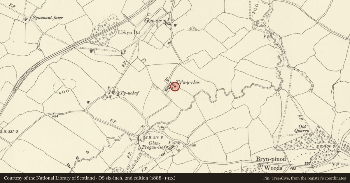
5 historical maps cover this location, the earliest the 1795 map "To Sir Watkin Williams-Wynn Bart ... the map of the six counties of North Wales is most humbly inscribed by his obedient humble servant" (Llyfrgell Genedlaethol Cymru – The National Library of Wales).
Historical maps covering this location
- 1795 · To Sir Watkin Williams-Wynn Bart ... the map of the six counties of North Wales is most… (Llyfrgell Genedlaethol Cymru – The National Library of Wales)
- 1883 · Watershed map England, Wales 3. (David Rumsey Map Collection, Stanford Libraries)
- 1897 · 137 Oswestry (Hills) (David Rumsey Map Collection, Stanford Libraries)
- 1901 · Sheet 9 and 10. (David Rumsey Map Collection, Stanford Libraries)
- 1916 · Sheet 60. Shrewsbury. (David Rumsey Map Collection, Stanford Libraries)
Cadw's description
Location
To east side of a minor road about 1 km south of the village of Llanfechain.
History
Early C19. It is noted in the Tite Survey (1839) as The Rhos, a farmhouse with yard and garden and 53 acres (21.45 hectares), owned by Thomas Evans and occupied by John Gittins.
Exterior
A two-storey three-window symmetrical farmhouse in brickwork with a hipped slate roof with generous eaves. The quality and texture of the slightly variegated local red brickwork is notable. Chimneys at the apex of the hips. Modern flat roofed extension at rear (to road); walled up upper windows in the side walls. Front windows all timber, of two-light casement type. Door at centre with side screens and hood. Upvc window at left (west) side, one modern window at rear.
Interior
Interior not seen.
Reason for designation
A farmhouse of late Regency appearance, providing an example of the use of a fine local type of red brickwork; notwithstanding an extension at rear it is largely unaltered and retains its character especially at front.
Nearby in the register
- Wern CottageDomesticunder 1 mi
- Glanbrogan Hall and Brogan-fach.Domesticunder 1 mi
- Domen Gastell FarmhouseAgriculture and Subsistenceunder 1 mi
- The MountDomesticunder 1 mi
Other entries of the same register within about three miles of this one, by straight line.