Cof Cymru: National Historic Assets of Wales · Wales
Old Talbot Inn
Llanfechain, Powys, Wales
A Grade II listed building in Llanfechain village, Llanfechain, Powys, designated on 28 January 2004.
The record
- Designation
- Listed building, Grade II
- Broad class
- Commercial
- Date of designation
- 28 January 2004
- Locality
- Llanfechain village
- Community
- Llanfechain
- Unitary authority
- Powys
- Country
- Wales
- Coordinates
- 52.77680, -3.20547
- Cadw reference
- 82430
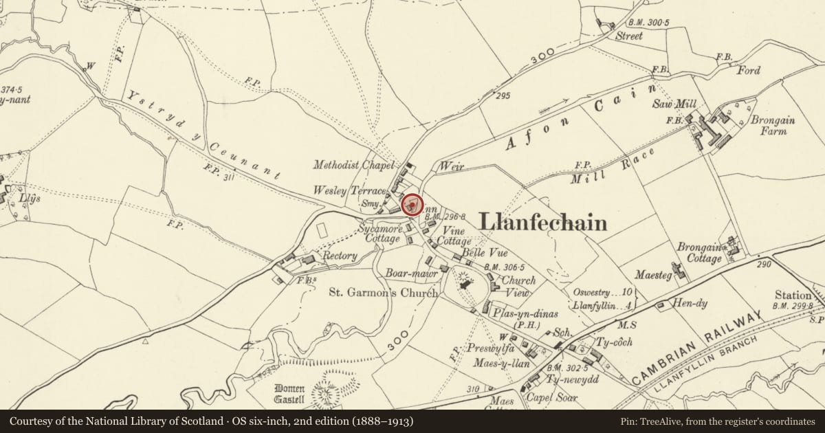
Slide toward Today to fade the historical sheet and see the modern map underneath.
David Rumsey Map Collection, Stanford LibrariesDavid Rumsey Map Collection, Stanford LibrariesDavid Rumsey Map Collection, Stanford LibrariesDavid Rumsey Map Collection, Stanford LibrariesLlyfrgell Genedlaethol Cymru – The National Library of Wales
5 historical maps cover this location, the earliest the 1795 map "To Sir Watkin Williams-Wynn Bart ... the map of the six counties of North Wales is most humbly inscribed by his obedient humble servant" (Llyfrgell Genedlaethol Cymru – The National Library of Wales).
Historical maps covering this location
- 1795 · To Sir Watkin Williams-Wynn Bart ... the map of the six counties of North Wales is most… (Llyfrgell Genedlaethol Cymru – The National Library of Wales)
- 1883 · Watershed map England, Wales 3. (David Rumsey Map Collection, Stanford Libraries)
- 1897 · 137 Oswestry (Hills) (David Rumsey Map Collection, Stanford Libraries)
- 1901 · Sheet 9 and 10. (David Rumsey Map Collection, Stanford Libraries)
- 1916 · Sheet 60. Shrewsbury. (David Rumsey Map Collection, Stanford Libraries)
Cadw's description
Location
At east side of road to the north side of Llanfechain Bridge.
History
Mid C19, the architecturally dominant building of Llanfechain north of the river. This building is not shown on the Tithe Map of c.1839 (although from its form an earlier origin might have been expected). It is marked as 'Talbot Inn' in the Ordnance Survey maps of 1884 and 1900, but has ceased to be an inn. The dormers and porch are not original.
Exterior
A 2½-storey, three-window rendered and white painted house of symmetrical design, with a steeply pitched slate roof with tile ridge and brick end-chimney stacks.
The windows are of hornless sash type, 16 panes, with stone sills. Semi-glazed central main door, restored, within a C20 lean-to glazed porch. Modern windows at sides. Two dormer windows at mid-height of the front roof with steel casements.
Interior
Interior not seen.
Reason for designation
A house of traditional style although apparently Victorian, and which has retained its character.
Nearby in the register
- Llanfechain BridgeTransportunder 1 mi
- Plas CainDomesticunder 1 mi
- Cain VillaDomesticunder 1 mi
- Church of St. GarmonReligious, Ritual and Funeraryunder 1 mi
Other entries of the same register within about three miles of this one, by straight line.