Cof Cymru: National Historic Assets of Wales · Wales
Old Barn at Hendre, Bodynfoel
Llanfechain, Powys, Wales
A Grade II listed building in Bodynfoel, Llanfechain, Powys, designated on 28 January 2004.
The record
- Designation
- Listed building, Grade II
- Broad class
- Agriculture and Subsistence
- Date of designation
- 28 January 2004
- Locality
- Bodynfoel
- Community
- Llanfechain
- Unitary authority
- Powys
- Country
- Wales
- Coordinates
- 52.77506, -3.22154
- Cadw reference
- 82428
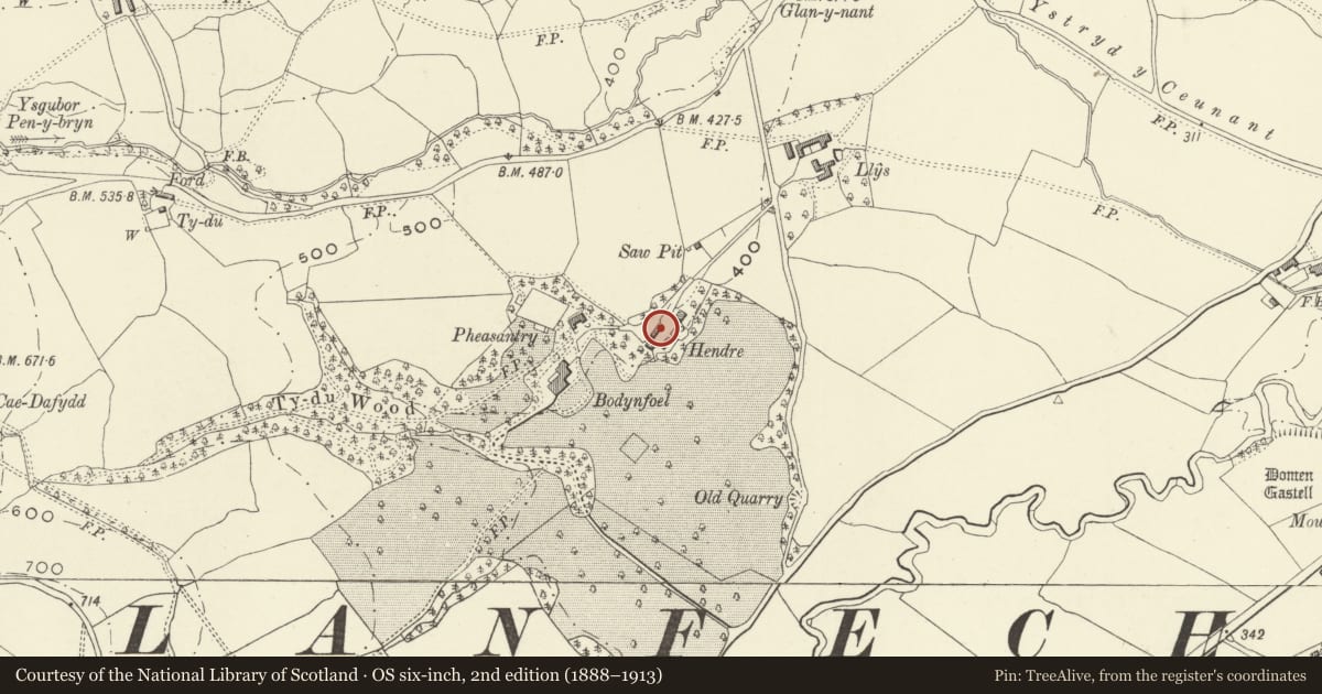
Slide toward Today to fade the historical sheet and see the modern map underneath.
David Rumsey Map Collection, Stanford LibrariesDavid Rumsey Map Collection, Stanford LibrariesDavid Rumsey Map Collection, Stanford LibrariesDavid Rumsey Map Collection, Stanford LibrariesLlyfrgell Genedlaethol Cymru – The National Library of Wales
5 historical maps cover this location, the earliest the 1795 map "To Sir Watkin Williams-Wynn Bart ... the map of the six counties of North Wales is most humbly inscribed by his obedient humble servant" (Llyfrgell Genedlaethol Cymru – The National Library of Wales).
Historical maps covering this location
- 1795 · To Sir Watkin Williams-Wynn Bart ... the map of the six counties of North Wales is most… (Llyfrgell Genedlaethol Cymru – The National Library of Wales)
- 1883 · Watershed map England, Wales 3. (David Rumsey Map Collection, Stanford Libraries)
- 1897 · 137 Oswestry (Hills) (David Rumsey Map Collection, Stanford Libraries)
- 1901 · Sheet 9 and 10. (David Rumsey Map Collection, Stanford Libraries)
- 1916 · Sheet 60. Shrewsbury. (David Rumsey Map Collection, Stanford Libraries)
Cadw's description
Location
At south side of the farm track leading from the north-east past Hendre to Bodynfoel Hall; about 150 m north-east of the Hall.
History
Perhaps C17, related to Hendre farm now in the grounds of Bodynfoel Hall.
Exterior
A five-bay timber-framed barn, sited on the contour with a considerable stone substructure on the south side. Horizontally boarded; random slate roof in graded courses with tile ridge. The wall framing is two panels high but concealed by the weatherboarding. Small lean-to at east, sheds at west.
Interior
Timber framed cross walls and trusses, three with tie beams and collars, one with raking queen posts.
Reason for designation
A good timber-framed and clad barn which has largely escaped alteration, listed also for group value with Bodynfoel Hall.
Nearby in the register
- Bodynfoel HallDomesticunder 1 mi
- Llys FarmhouseAgriculture and Subsistenceunder 1 mi
- Llys Old Farmhouse and Outbuildings RangeAgriculture and Subsistenceunder 1 mi
- PentreDomesticunder 1 mi
Other entries of the same register within about three miles of this one, by straight line.