Cof Cymru: National Historic Assets of Wales · Wales
Fourth arch over South Wales Railway at Peniel Green
Llansamlet, Swansea, Wales
A Grade II listed building in Peniel Green, Swansea, Llansamlet, designated on 16 January 2004.
The record
- Designation
- Listed building, Grade II
- Broad class
- Transport
- Date of designation
- 16 January 2004
- Locality
- Peniel Green
- Town
- Swansea
- Community
- Llansamlet
- Unitary authority
- Swansea
- Country
- Wales
- Coordinates
- 51.66071, -3.87734
- Cadw reference
- 82385
Slide toward Today to fade the historical sheet and see the modern map underneath.
David Rumsey Map Collection, Stanford LibrariesDavid Rumsey Map Collection, Stanford LibrariesDavid Rumsey Map Collection, Stanford LibrariesDavid Rumsey Map Collection, Stanford LibrariesDavid Rumsey Map Collection, Stanford Libraries
5 historical maps cover this location, the earliest the 1636 map "Cornubia : Devonia, Somersetus, Dorcestria, Wiltonia, Glocestria ..." (David Rumsey Map Collection, Stanford Libraries).
Historical maps covering this location
- 1636 · Cornubia : Devonia, Somersetus, Dorcestria, Wiltonia, Glocestria ... (David Rumsey Map Collection, Stanford Libraries)
- 1637 · The fourth table of England. Cornub. Devonia, Somerset etc. (David Rumsey Map Collection, Stanford Libraries)
- 1865 · England and Wales. England No. 6. (David Rumsey Map Collection, Stanford Libraries)
- 1891 · Sheet 10. Ordnance Survey of England and Wales. . (David Rumsey Map Collection, Stanford Libraries)
- 1897 · 247 Swansea (Hills) (David Rumsey Map Collection, Stanford Libraries)
Cadw's description
Location
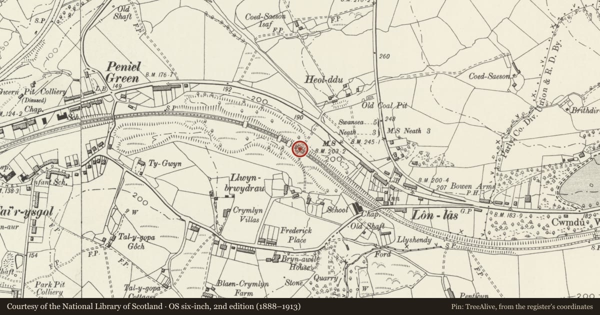
Crossing the South Wales Railway some 525m SE of Llansamlet station. This arch is the most S structure as the railway curves S.
History
One of four hump-backed flying arches built over railway line and intended to stabilise the cutting banks where slips had occured shortly after the line opened in 1850. The line was engineered by I. K. Brunel for the South Wales Railway. The arches are shown on the 1885 OS map which also shows a track crossing this fourth arch N from Llwynbrydrau to Peniel Green Road.
Exterior
One of four broad stone arches of rubble stone with cut stone voussoirs to segmental arches. Arches are some 12m wide and approximately 20 to 25m long. Arches are weighted on top with copper slag and provided with retaining walls on each side holding back earth.
Reason for designation
Included for its special historic interest as one of four unusual engineering structures, probably by I. K. Brunel, the renowned Victorian engineer.
Nearby in the register
- Third arch over South Wales Railway at Peniel GreenNo class recordedunder 1 mi
- Second arch over South Wales Railway at Peniel GreenTransportunder 1 mi
- First arch over South Wales Railway at Peniel GreenNo class recordedunder 1 mi
- Lonlas or Llwynbrydrau bridgeTransportunder 1 mi
Other entries of the same register within about three miles of this one, by straight line.