Cof Cymru: National Historic Assets of Wales · Wales
Pont ar Dawe (partly in Pontardawe community)
Cilybebyll, Neath Port Talbot, Wales
A Grade II listed building in Pontardawe, Swansea, Cilybebyll, Neath Port Talbot, designated on 26 October 1979.
The record
- Designation
- Listed building, Grade II
- Broad class
- Transport
- Date of designation
- 26 October 1979
- Locality
- Pontardawe
- Town
- Swansea
- Community
- Cilybebyll
- Unitary authority
- Neath Port Talbot
- Country
- Wales
- Coordinates
- 51.71752, -3.84726
- Cadw reference
- 82294
Slide toward Today to fade the historical sheet and see the modern map underneath.
David Rumsey Map Collection, Stanford LibrariesDavid Rumsey Map Collection, Stanford LibrariesDavid Rumsey Map Collection, Stanford LibrariesDavid Rumsey Map Collection, Stanford LibrariesDavid Rumsey Map Collection, Stanford Libraries
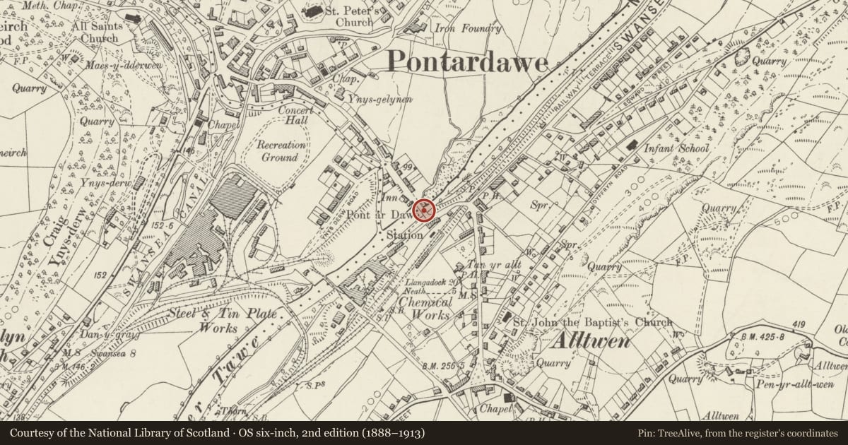
5 historical maps cover this location, the earliest the 1636 map "Cornubia : Devonia, Somersetus, Dorcestria, Wiltonia, Glocestria ..." (David Rumsey Map Collection, Stanford Libraries).
Historical maps covering this location
- 1636 · Cornubia : Devonia, Somersetus, Dorcestria, Wiltonia, Glocestria ... (David Rumsey Map Collection, Stanford Libraries)
- 1637 · The fourth table of England. Cornub. Devonia, Somerset etc. (David Rumsey Map Collection, Stanford Libraries)
- 1891 · Sheet 10. Ordnance Survey of England and Wales. . (David Rumsey Map Collection, Stanford Libraries)
- 1898 · 230 Ammanford (Hills) (David Rumsey Map Collection, Stanford Libraries)
- 1898 · 230 Ammanford (Outline) (David Rumsey Map Collection, Stanford Libraries)
Cadw's description
Location
Spanning the Afon Tawe between the communities of Cilybebyll and Pontardawe.
History
Road bridge over the Tawe, now disused as a vehicle crossing, uncertain date possibly c1765 or possibly 1784, by Rev. William Edwards of Pontypridd. Originally some 3m wide, widened to 8.2m in 1893 with new parapets. G. Breese says that this is not the bridge built by Edwards c1765 as that had spandrel holes like Edwards famous bridge at Pontypridd , but all other sources say that this is the Edwards bridge. The bridge is mentioned by B. Malkin in 1804 and by T.Rees in 1819 when the abutments are said to have been solid.
Exterior
Road bridge, rubble stone, broad single arch of 26m span with thin stone voussoirs and thin stones to original spandrels and crown on S side. Abutments each side have battered faces. Later C19 doubling in width in rock-faced squared sandstone with cut stone voussoirs. Parapets on both sides also later C19 with rock-faced chamfered coping stones with tooled edges. Raised piers at ends of parapets with ridge-back copings.
Reason for designation
Included as an important C18 road bridge by the leading Welsh bridge builder.
Nearby in the register
- Pont ar Dawe (partly in Cilybebyll community)Transportunder 1 mi
- The War MemorialReligious, Ritual and Funeraryunder 1 mi
- Memorial drinking fountain and railingsCommemorativeunder 1 mi
- Upper Clydach Aqueduct and Overflow on Swansea CanalWater Supply and Drainageunder 1 mi
Other entries of the same register within about three miles of this one, by straight line.