Cof Cymru: National Historic Assets of Wales · Wales
Bridge over former Vale of Neath Railway
Resolven, Neath Port Talbot, Wales
A Grade II listed building in Resolven, Neath, Neath Port Talbot, designated on 15 December 2003.
The record
- Designation
- Listed building, Grade II
- Broad class
- Transport
- Date of designation
- 15 December 2003
- Locality
- Resolven
- Town
- Neath
- Community
- Resolven
- Unitary authority
- Neath Port Talbot
- Country
- Wales
- Coordinates
- 51.71120, -3.69347
- Cadw reference
- 82267
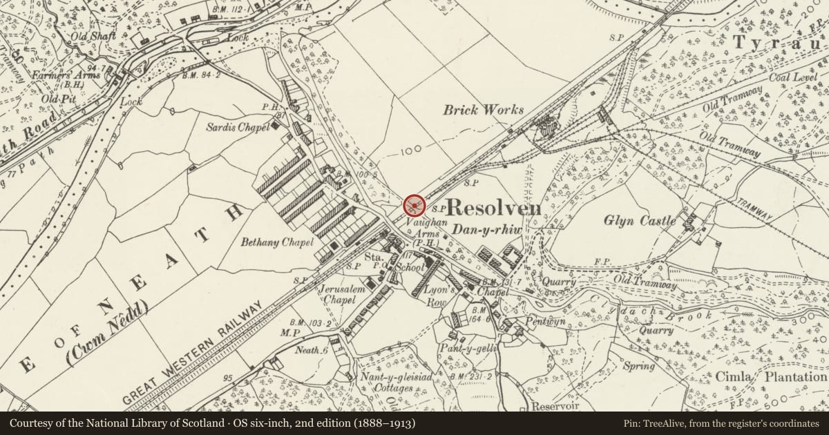
Slide toward Today to fade the historical sheet and see the modern map underneath.
David Rumsey Map Collection, Stanford LibrariesDavid Rumsey Map Collection, Stanford LibrariesDavid Rumsey Map Collection, Stanford LibrariesDavid Rumsey Map Collection, Stanford LibrariesDavid Rumsey Map Collection, Stanford Libraries
5 historical maps cover this location, the earliest the 1636 map "Cornubia : Devonia, Somersetus, Dorcestria, Wiltonia, Glocestria ..." (David Rumsey Map Collection, Stanford Libraries).
Historical maps covering this location
- 1636 · Cornubia : Devonia, Somersetus, Dorcestria, Wiltonia, Glocestria ... (David Rumsey Map Collection, Stanford Libraries)
- 1637 · The fourth table of England. Cornub. Devonia, Somerset etc. (David Rumsey Map Collection, Stanford Libraries)
- 1830 · V.3:11-15:XV. Britisches Reich. A. Kon: England. b. Frstenthum Wales: Shire: 37-40 (David Rumsey Map Collection, Stanford Libraries)
- 1865 · England and Wales. England No. 6. (David Rumsey Map Collection, Stanford Libraries)
- 1898 · 231 Merthyr Tydfil (Hills) (David Rumsey Map Collection, Stanford Libraries)
Cadw's description
Location
Crossing the former Vale of Neath Railway just NE of the centre of Resolven.
History
Road bridge over former Vale of Neath Railway broad gauge double track built c1850 probably to designs of I.K. Brunel. The Act for the railway from Neath to Aberdare (with a branch to Merthyr) was passed in 1846 and construction began shortly after with I K Brunel as the engineer. The line to Aberdare was opened to goods and passengers in 1851 and the Merthyr branch from Gelli Tarw Junction in 1853.
Exterior
Railway bridge, coursed squared rubble stone with broad elliptical arch. Cut tooled sandstone voussoirs, raised stone string course under parapet with C20 cement copings. Cement deck.
Reason for designation
Included as a fine unaltered C19 stone bridge probably designed by Brunel, the renowned Victorian engineer.
Nearby in the register
- Clydach Brook aqueduct over former Vale of Neath RailwayTransportunder 1 mi
- Jerusalem Independent ChapelReligious, Ritual and Funeraryunder 1 mi
- Pant y GelliDomesticunder 1 mi
- Farmer's Arms aqueduct over the Neath CanalWater Supply and Drainageunder 1 mi
Other entries of the same register within about three miles of this one, by straight line.