Cof Cymru: National Historic Assets of Wales · Wales
Preseli
Carmarthen, Carmarthenshire, Wales
A Grade II listed building in Carmarthen, Carmarthenshire, designated on 28 November 2003.
The record
- Designation
- Listed building, Grade II
- Broad class
- No class recorded
- Date of designation
- 28 November 2003
- Community
- Carmarthen
- Unitary authority
- Carmarthenshire
- Country
- Wales
- Coordinates
- 51.85660, -4.31480
- Cadw reference
- 82196
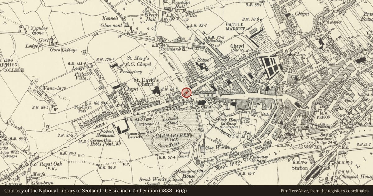
Slide toward Today to fade the historical sheet and see the modern map underneath.
David Rumsey Map Collection, Stanford LibrariesDavid Rumsey Map Collection, Stanford LibrariesDavid Rumsey Map Collection, Stanford LibrariesDavid Rumsey Map Collection, Stanford LibrariesDavid Rumsey Map Collection, Stanford Libraries
5 historical maps cover this location, the earliest the 1636 map "Cornubia : Devonia, Somersetus, Dorcestria, Wiltonia, Glocestria ..." (David Rumsey Map Collection, Stanford Libraries).
Historical maps covering this location
- 1636 · Cornubia : Devonia, Somersetus, Dorcestria, Wiltonia, Glocestria ... (David Rumsey Map Collection, Stanford Libraries)
- 1860 · 41. Caermathen. (David Rumsey Map Collection, Stanford Libraries)
- 1891 · Sheet 10. Ordnance Survey of England and Wales. . (David Rumsey Map Collection, Stanford Libraries)
- 1898 · 229 Carmarthen (Hills) (David Rumsey Map Collection, Stanford Libraries)
- 1901 · Sheet 14. (David Rumsey Map Collection, Stanford Libraries)
Cadw's description
Location
Situated on roundabout at SW end of street.
History
End terrace house probably mid C19, not marked on 1834 map.
Exterior
House in painted stucco with slate roof with bargeboarded gable to front. Two storeys with basement and attic, irregular 2-window front with raised plinth, 12-pane horned sashes and raised surrounds to all openings. Ground floor has 4-panel timber door to right with large rectangular overlight and 3 stone steps. Two sashes, to centre and left with painted stone sills. First floor has 2 sashes close-set to centre and short raised band linking heads. Gable has small 4-pane roundel in surround with 4 keystones. Rubble stone gable end to right with gable-ended full-height extension to rear with slate roof.
Interior
Not available for inspection.
Reason for designation
Included as an unusually-designed C19 house with gable front, prominently sited in the approach from Lammas Street, of group value with the adjoining building (1 Saint David''s Avenue).
Nearby in the register
- 1 St David's AvenueDomesticunder 1 mi
- Christ ChurchReligious, Ritual and Funeraryunder 1 mi
- Main gates and gatepiers to Carmarthen ParkCivilunder 1 mi
- Eastern pair of lamp standards in Carmarthen ParkCivilunder 1 mi
Other entries of the same register within about three miles of this one, by straight line.