Cof Cymru: National Historic Assets of Wales · Wales
8 Mansel Street
Carmarthen, Carmarthenshire, Wales
A Grade II listed building in Carmarthen, Carmarthenshire, designated on 28 November 2003.
The record
- Designation
- Listed building, Grade II
- Broad class
- Commercial
- Date of designation
- 28 November 2003
- Community
- Carmarthen
- Unitary authority
- Carmarthenshire
- Country
- Wales
- Coordinates
- 51.85690, -4.31011
- Cadw reference
- 82138
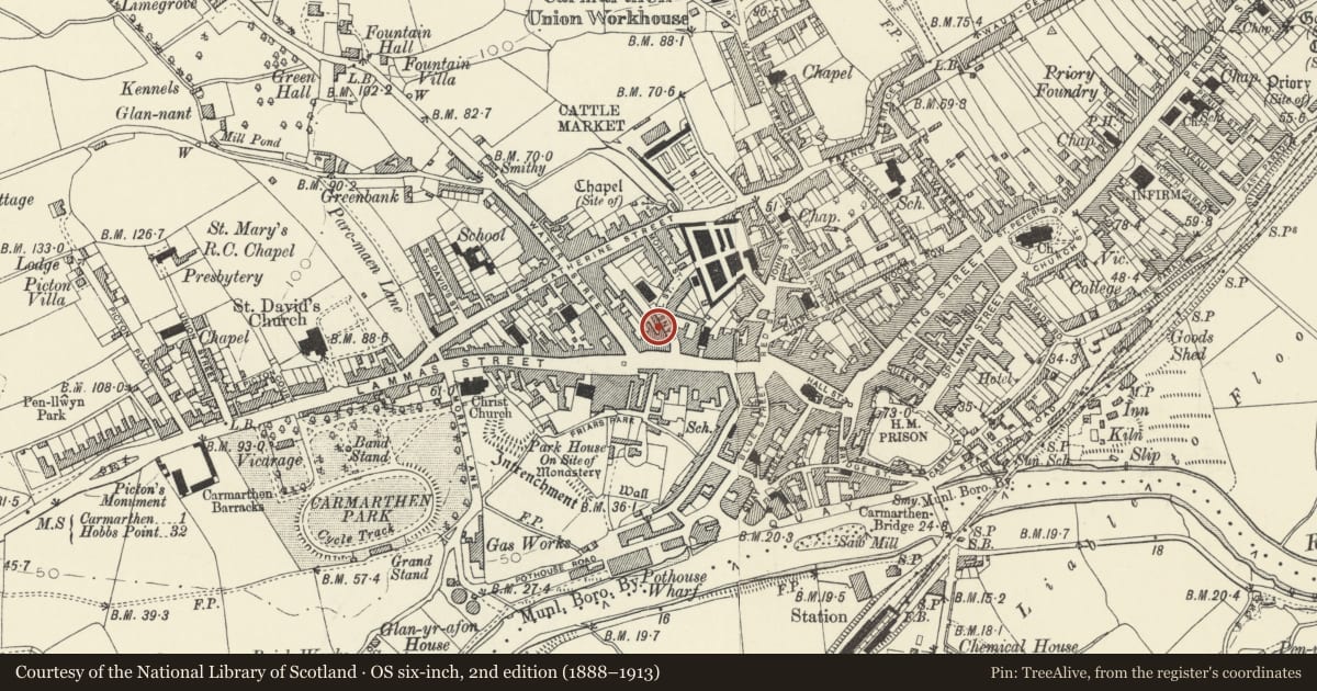
Slide toward Today to fade the historical sheet and see the modern map underneath.
David Rumsey Map Collection, Stanford LibrariesDavid Rumsey Map Collection, Stanford LibrariesDavid Rumsey Map Collection, Stanford LibrariesDavid Rumsey Map Collection, Stanford LibrariesDavid Rumsey Map Collection, Stanford Libraries
5 historical maps cover this location, the earliest the 1636 map "Cornubia : Devonia, Somersetus, Dorcestria, Wiltonia, Glocestria ..." (David Rumsey Map Collection, Stanford Libraries).
Historical maps covering this location
- 1636 · Cornubia : Devonia, Somersetus, Dorcestria, Wiltonia, Glocestria ... (David Rumsey Map Collection, Stanford Libraries)
- 1860 · 41. Caermathen. (David Rumsey Map Collection, Stanford Libraries)
- 1891 · Sheet 10. Ordnance Survey of England and Wales. . (David Rumsey Map Collection, Stanford Libraries)
- 1898 · 229 Carmarthen (Hills) (David Rumsey Map Collection, Stanford Libraries)
- 1901 · Sheet 14. (David Rumsey Map Collection, Stanford Libraries)
Cadw's description
Location
Situated at left end of terrace of 3, S of Zion Chapel.
History
End house of matching terrace of 3 later C19 houses, built as 2-window house, extended by one bay to left. Offices of H.D. Pritchard & Co, accountants, in 2002.
Exterior
End-terrace house, painted stucco, slate gabled roof with boxed eaves and shared yellow brick stepped-cap stack to right. Two-storey, 3-window range of plate-glass sashes with central doorway, which has moulded surround. Moulded string course just below first floor sill level. Single step up to 6-panelled door with deep plain overlight. The windows of the left bay have slightly lower heads showing that this bay is added.
Reason for designation
Included as part of a little altered later C19 terrace of group value with Zion chapel.
Nearby in the register
- 7 Mansel StreetDomesticunder 1 mi
- Ty ManselNo class recordedunder 1 mi
- Forecourt railings and gates to Zion ChapelReligious, Ritual and Funeraryunder 1 mi
- 18 Lammas StreetCommercialunder 1 mi
Other entries of the same register within about three miles of this one, by straight line.