Cof Cymru: National Historic Assets of Wales · Wales
67 Trevaughan Road
Carmarthen, Carmarthenshire, Wales
A Grade II listed building in Carmarthen, Carmarthenshire, designated on 19 May 1981.
The record
- Designation
- Listed building, Grade II
- Broad class
- Domestic
- Date of designation
- 19 May 1981
- Community
- Carmarthen
- Unitary authority
- Carmarthenshire
- Country
- Wales
- Coordinates
- 51.87020, -4.32487
- Cadw reference
- 82133
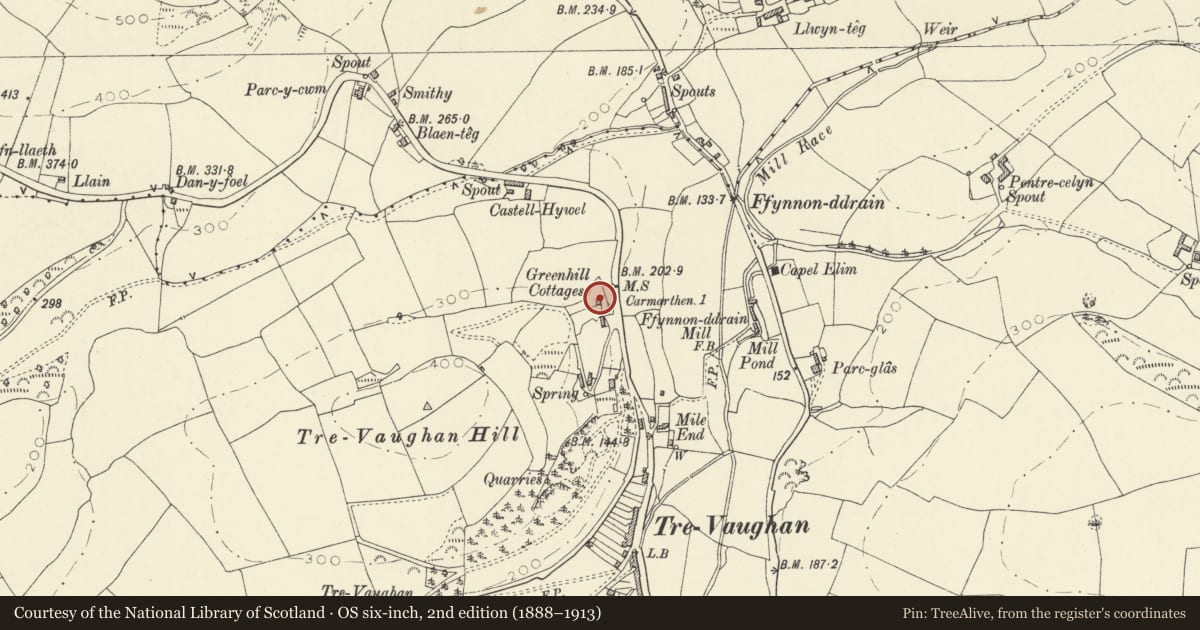
Slide toward Today to fade the historical sheet and see the modern map underneath.
David Rumsey Map Collection, Stanford LibrariesDavid Rumsey Map Collection, Stanford LibrariesDavid Rumsey Map Collection, Stanford LibrariesDavid Rumsey Map Collection, Stanford LibrariesDavid Rumsey Map Collection, Stanford Libraries
5 historical maps cover this location, the earliest the 1636 map "Cornubia : Devonia, Somersetus, Dorcestria, Wiltonia, Glocestria ..." (David Rumsey Map Collection, Stanford Libraries).
Historical maps covering this location
- 1636 · Cornubia : Devonia, Somersetus, Dorcestria, Wiltonia, Glocestria ... (David Rumsey Map Collection, Stanford Libraries)
- 1830 · V.3:11-15:XV. Britisches Reich. A. Kon: England. b. Frstenthum Wales: Shire: 37-40 (David Rumsey Map Collection, Stanford Libraries)
- 1860 · 41. Caermathen. (David Rumsey Map Collection, Stanford Libraries)
- 1891 · Sheet 10. Ordnance Survey of England and Wales. . (David Rumsey Map Collection, Stanford Libraries)
- 1901 · Sheet 14. (David Rumsey Map Collection, Stanford Libraries)
Cadw's description
Location
Situated as one of a pair of cottages up track W of Trevaughan Road, opposite the milestone to Carmarthen.
History
One of a pair of earlier C19 Georgian Gothic cottages said to have been built for quarry workers, though of estate cottage type.
Exterior
One of a pair of cottages with No 65. The 2 cottages have painted stucco front, remainder in whitewashed rubble, with end stacks to close-eaved slate roof. Raised plinth. Four-centred pointed heads to all openings on 2-storey, 3-window front, with 3 windows to first floor, the centre window over 2 doors with similar heads. Stone step up to 2 boarded timber doors. Windows are 2-light with tiny panes to lights with 4-centred pointed heads and glazed pane in top spandrel. Painted stone sills. Rubble right end stack possibly truncated. Renewed red brick left stack. Whitewashed rubble right gable end, No 67, with small window each floor in end of rear outshut. To left, Slate-hung gable to left, No 65.
Interior
Dog-leg stair with stick balusters.
Reason for designation
Included with No 65 as an exceptional C19 Gothic cottage pair.
Nearby in the register
- 65 Trevaughan RoadDomesticunder 1 mi
- Milestone in TrevaughanTransportunder 1 mi
- Gates and railings to Capel ElimReligious, Ritual and Funeraryunder 1 mi
- Elim independent ChapelReligious, Ritual and Funeraryunder 1 mi
Other entries of the same register within about three miles of this one, by straight line.