Cof Cymru: National Historic Assets of Wales · Wales
49 King Street
Carmarthen, Carmarthenshire, Wales
A Grade II listed building in Carmarthen, Carmarthenshire, designated on 28 November 2003.
The record
- Designation
- Listed building, Grade II
- Broad class
- Commercial
- Date of designation
- 28 November 2003
- Community
- Carmarthen
- Unitary authority
- Carmarthenshire
- Country
- Wales
- Coordinates
- 51.85706, -4.30513
- Cadw reference
- 82126
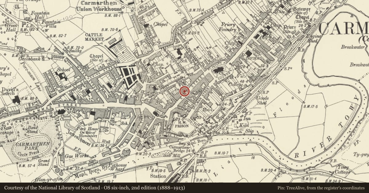
Slide toward Today to fade the historical sheet and see the modern map underneath.
David Rumsey Map Collection, Stanford LibrariesDavid Rumsey Map Collection, Stanford LibrariesDavid Rumsey Map Collection, Stanford LibrariesDavid Rumsey Map Collection, Stanford LibrariesDavid Rumsey Map Collection, Stanford Libraries
5 historical maps cover this location, the earliest the 1636 map "Cornubia : Devonia, Somersetus, Dorcestria, Wiltonia, Glocestria ..." (David Rumsey Map Collection, Stanford Libraries).
Historical maps covering this location
- 1636 · Cornubia : Devonia, Somersetus, Dorcestria, Wiltonia, Glocestria ... (David Rumsey Map Collection, Stanford Libraries)
- 1860 · 41. Caermathen. (David Rumsey Map Collection, Stanford Libraries)
- 1891 · Sheet 10. Ordnance Survey of England and Wales. . (David Rumsey Map Collection, Stanford Libraries)
- 1898 · 229 Carmarthen (Hills) (David Rumsey Map Collection, Stanford Libraries)
- 1901 · Sheet 14. (David Rumsey Map Collection, Stanford Libraries)
Cadw's description
Location
Situated opposite Probate Office, some 50m NE of junction with Jackson's Lane.
History
Right house of an earlier C19 pair of houses with No 50. In 1926 occupied by I. Thomas hosier, in 2002 a bakery.
Exterior
Terrace house with shop, a pair with No 50 to left. Both houses are of brick with painted roughcast cladding, 3-storeys and 2-bays, offset to left on No 49. Slate eaves roofs with brick chimney to right and eaves cornice with paired modillions. Small paned sash windows to upper floors, replaced with C20 glazing on No 49, 12-pane sashes surviving on No 50. C20 full-width shopfronts.
Rear of No 49 has added taller one-window parallel rear range with C20 windows on 4 floors.
Interior
Ground floor all altered, stair enclosed.
Reason for designation
Included with No 50 as one of a pair of early C19 stuccoed houses with some original detail surviving and for group value.
Nearby in the register
- 50 King StreetCommercialunder 1 mi
- No 51 including near-detached rear wingCommercialunder 1 mi
- 52 King StreetCommercialunder 1 mi
- The Post Office (left hand building)Commercialunder 1 mi
Other entries of the same register within about three miles of this one, by straight line.