Cof Cymru: National Historic Assets of Wales · Wales
23 Lammas Street
Carmarthen, Carmarthenshire, Wales
A Grade II listed building in Carmarthen, Carmarthenshire, designated on 28 November 2003.
The record
- Designation
- Listed building, Grade II
- Broad class
- Commercial
- Date of designation
- 28 November 2003
- Community
- Carmarthen
- Unitary authority
- Carmarthenshire
- Country
- Wales
- Coordinates
- 51.85658, -4.31128
- Cadw reference
- 82113
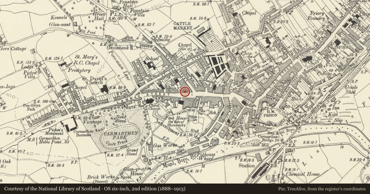
Slide toward Today to fade the historical sheet and see the modern map underneath.
David Rumsey Map Collection, Stanford LibrariesDavid Rumsey Map Collection, Stanford LibrariesDavid Rumsey Map Collection, Stanford LibrariesDavid Rumsey Map Collection, Stanford LibrariesDavid Rumsey Map Collection, Stanford Libraries
5 historical maps cover this location, the earliest the 1636 map "Cornubia : Devonia, Somersetus, Dorcestria, Wiltonia, Glocestria ..." (David Rumsey Map Collection, Stanford Libraries).
Historical maps covering this location
- 1636 · Cornubia : Devonia, Somersetus, Dorcestria, Wiltonia, Glocestria ... (David Rumsey Map Collection, Stanford Libraries)
- 1860 · 41. Caermathen. (David Rumsey Map Collection, Stanford Libraries)
- 1891 · Sheet 10. Ordnance Survey of England and Wales. . (David Rumsey Map Collection, Stanford Libraries)
- 1898 · 229 Carmarthen (Hills) (David Rumsey Map Collection, Stanford Libraries)
- 1901 · Sheet 14. (David Rumsey Map Collection, Stanford Libraries)
Cadw's description
Location
Situated opposite Heol Awst chapel sunday school.
History
Earlier C19 house with shop, in informal terraced row, marked as built up on 1834 map. The Golden Lion inn was at 23 Lammas Street, now at No 102.
Exterior
House in informal terrace, painted render with steep slate roof and end wall stacks, 3-storey, 3-window range of 6-pane sashes over C20 shop with throughway to rear yard to right.
Interior
Ground floor altered.
Reason for designation
Included as a late Georgian style terraced house of group value with No 22.
Nearby in the register
- Waverly HouseCommercialunder 1 mi
- Railings, gates and gatepiers to Capel Heol Awst and Sunday SchoolReligious, Ritual and Funeraryunder 1 mi
- Sunday School to Capel Heol AwstReligious, Ritual and Funeraryunder 1 mi
- The Drovers ArmsCommercialunder 1 mi
Other entries of the same register within about three miles of this one, by straight line.