Cof Cymru: National Historic Assets of Wales · Wales
16 Queen Street
Carmarthen, Carmarthenshire, Wales
A Grade II listed building in Carmarthen, Carmarthenshire, designated on 28 November 2003.
The record
- Designation
- Listed building, Grade II
- Broad class
- Commercial
- Date of designation
- 28 November 2003
- Community
- Carmarthen
- Unitary authority
- Carmarthenshire
- Country
- Wales
- Coordinates
- 51.85619, -4.30513
- Cadw reference
- 82104
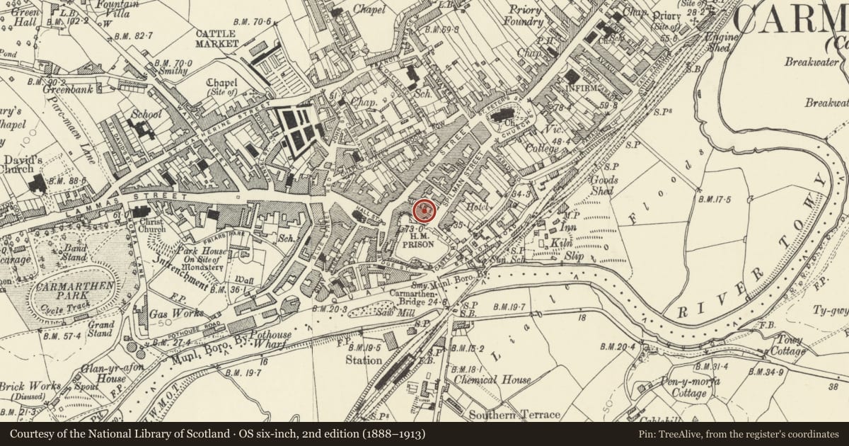
Slide toward Today to fade the historical sheet and see the modern map underneath.
David Rumsey Map Collection, Stanford LibrariesDavid Rumsey Map Collection, Stanford LibrariesDavid Rumsey Map Collection, Stanford LibrariesDavid Rumsey Map Collection, Stanford LibrariesDavid Rumsey Map Collection, Stanford Libraries
5 historical maps cover this location, the earliest the 1636 map "Cornubia : Devonia, Somersetus, Dorcestria, Wiltonia, Glocestria ..." (David Rumsey Map Collection, Stanford Libraries).
Historical maps covering this location
- 1636 · Cornubia : Devonia, Somersetus, Dorcestria, Wiltonia, Glocestria ... (David Rumsey Map Collection, Stanford Libraries)
- 1860 · 41. Caermathen. (David Rumsey Map Collection, Stanford Libraries)
- 1891 · Sheet 10. Ordnance Survey of England and Wales. . (David Rumsey Map Collection, Stanford Libraries)
- 1898 · 229 Carmarthen (Hills) (David Rumsey Map Collection, Stanford Libraries)
- 1901 · Sheet 14. (David Rumsey Map Collection, Stanford Libraries)
Cadw's description
Location
Situated some 25m from corner of Spilman Street.
History
Earlier C20 commercial building, perhaps a refronting, as site is marked as built up on 1834 map, but all detail earlier C20. Renovated 2002 and used as shop linked to Mount Antiques premises in The Mount behind.
Exterior
Terraced shop, unpainted stucco with slate roof and red brick stack at left. Two-storey, 3-window range with raised plinth, channelled ground floor, cornice over, moulded first floor sill band, and moulded eaves. Both floors have large tripartite sash each side of centre, first floor plate glass centre sash, and central door with overlight. Later C20 6-panel door, the top 4 panels fielded.
Interior
Earlier C20 dog-leg staircase with closed string, turned newels and balusters.
Reason for designation
Included as an earlier C20 commercial building of group value with Nos 17 and 18 to left.
Nearby in the register
- 17 Queen StreetDomesticunder 1 mi
- Premises occupied by Mount AntiquesCommercialunder 1 mi
- 3 Queen StreetCommercialunder 1 mi
- 2 Queen StreetCommercialunder 1 mi
Other entries of the same register within about three miles of this one, by straight line.