Cof Cymru: National Historic Assets of Wales · Wales
107 Lammas Street
Carmarthen, Carmarthenshire, Wales
A Grade II listed building in Carmarthen, Carmarthenshire, designated on 28 November 2003.
The record
- Designation
- Listed building, Grade II
- Broad class
- Commercial
- Date of designation
- 28 November 2003
- Community
- Carmarthen
- Unitary authority
- Carmarthenshire
- Country
- Wales
- Coordinates
- 51.85630, -4.31106
- Cadw reference
- 82099
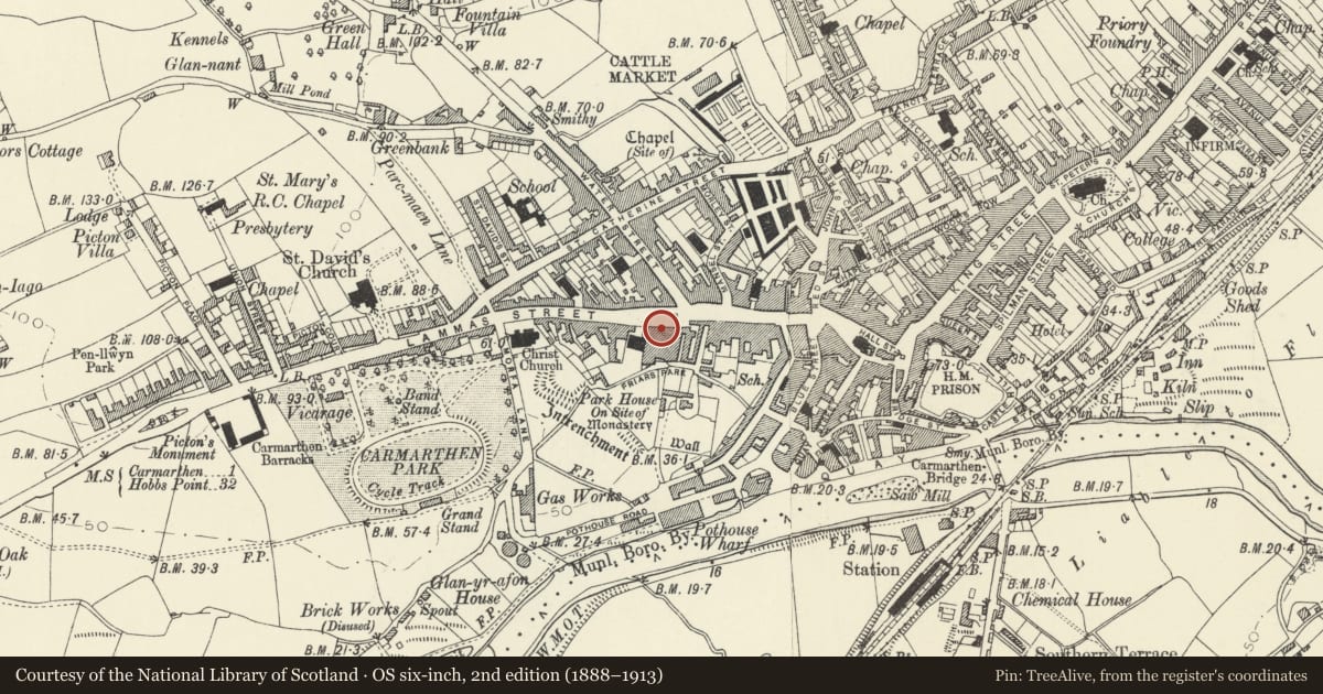
Slide toward Today to fade the historical sheet and see the modern map underneath.
David Rumsey Map Collection, Stanford LibrariesDavid Rumsey Map Collection, Stanford LibrariesDavid Rumsey Map Collection, Stanford LibrariesDavid Rumsey Map Collection, Stanford LibrariesDavid Rumsey Map Collection, Stanford Libraries
5 historical maps cover this location, the earliest the 1636 map "Cornubia : Devonia, Somersetus, Dorcestria, Wiltonia, Glocestria ..." (David Rumsey Map Collection, Stanford Libraries).
Historical maps covering this location
- 1636 · Cornubia : Devonia, Somersetus, Dorcestria, Wiltonia, Glocestria ... (David Rumsey Map Collection, Stanford Libraries)
- 1860 · 41. Caermathen. (David Rumsey Map Collection, Stanford Libraries)
- 1891 · Sheet 10. Ordnance Survey of England and Wales. . (David Rumsey Map Collection, Stanford Libraries)
- 1898 · 229 Carmarthen (Hills) (David Rumsey Map Collection, Stanford Libraries)
- 1901 · Sheet 14. (David Rumsey Map Collection, Stanford Libraries)
Cadw's description
Location
Situated approximately midway along street.
History
Terraced house with shop, later C19 external detail but possibly late C18 in origin, marked on 1834 map. Shop premises occupied by hairdressers, 2002.
Exterior
Terraced house with shop front, painted stucco, with slate gabled roof with wooden bracketed arcaded eaves cornice. No chimneys. Three-storey, 2-window range, upper floors with channelled angle piers, second floor tripartite sash windows, and first floor canted oriel windows with plate glass sashes and cornices. Oriels renewed in late C20. Ground floor with house doorway to left and late C19 shop front to right with plate glass window either side of recessed glazed shop door, door renewed in late C20. Overall fascia and modillion cornice with ornate consoles in fascia, 2 either side of left doorway and 2 either side of shop front. C20 house door and overlight. Raised plinth.
Interior
Altered ground floor, said to be generally altered within.
Reason for designation
Included as possibly late C18 with good late C19 commercial character including shop-front.
Nearby in the register
- The Drovers ArmsCommercialunder 1 mi
- Sunday School to Capel Heol AwstReligious, Ritual and Funeraryunder 1 mi
- Royal Welch Fusiliers Monuments and railingsCommemorativeunder 1 mi
- Railings, gates and gatepiers to Capel Heol Awst and Sunday SchoolReligious, Ritual and Funeraryunder 1 mi
Other entries of the same register within about three miles of this one, by straight line.