Cof Cymru: National Historic Assets of Wales · Wales
Former Stables at Aberdulais Falls Tinplate Works
Blaenhonddan, Neath Port Talbot, Wales
A Grade II listed building in Aberdulais, Neath, Blaenhonddan, Neath Port Talbot, designated on 26 November 2003.
The record
- Designation
- Listed building, Grade II
- Broad class
- Industrial
- Date of designation
- 26 November 2003
- Locality
- Aberdulais
- Town
- Neath
- Community
- Blaenhonddan
- Unitary authority
- Neath Port Talbot
- Country
- Wales
- Coordinates
- 51.68034, -3.77769
- Cadw reference
- 82082
Slide toward Today to fade the historical sheet and see the modern map underneath.
David Rumsey Map Collection, Stanford LibrariesDavid Rumsey Map Collection, Stanford LibrariesDavid Rumsey Map Collection, Stanford LibrariesDavid Rumsey Map Collection, Stanford LibrariesDavid Rumsey Map Collection, Stanford Libraries
5 historical maps cover this location, the earliest the 1636 map "Cornubia : Devonia, Somersetus, Dorcestria, Wiltonia, Glocestria ..." (David Rumsey Map Collection, Stanford Libraries).
Historical maps covering this location
- 1636 · Cornubia : Devonia, Somersetus, Dorcestria, Wiltonia, Glocestria ... (David Rumsey Map Collection, Stanford Libraries)
- 1637 · The fourth table of England. Cornub. Devonia, Somerset etc. (David Rumsey Map Collection, Stanford Libraries)
- 1865 · England and Wales. England No. 6. (David Rumsey Map Collection, Stanford Libraries)
- 1891 · Sheet 10. Ordnance Survey of England and Wales. . (David Rumsey Map Collection, Stanford Libraries)
- 1897 · 247 Swansea (Hills) (David Rumsey Map Collection, Stanford Libraries)
Cadw's description
Location
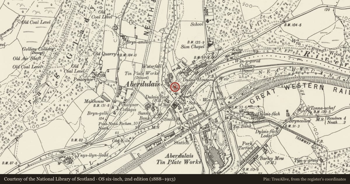
The former tinplate works are on the E bank of the Afon Dulais just N of Main Road.
History
Building associated with the works at Aberdulais. It is said to have been built as stables, marked on later C19 25 inch OS map. Now information centre for Aberdulais Falls site, converted 1984 by Mitchell & Holden of Carmarthen.
Exterior
Outbuilding, former stables, whitewashed rubble stone with slate roof and broad front gable end. Brick cambered arches to openings, one large centre loft opening, broad coach entry to ground floor left and broad short window to right. Windows are boarded. Windowless right side wall.
Interior
Interior wholly altered.
Reason for designation
Included for group value as one of the two whitewashed stone buildings at the entrance to the industrial site. The tinplate works are a Scheduled Ancient Monument (GM485).
Nearby in the register
- Remains of tramroad bridge at Aberdulais Falls Tinplate WorksTransportunder 1 mi
- Old Works Library at Aberdulais Falls Tinplate WorksHealth and Welfareunder 1 mi
- Tinplate works at Aberdulais FallsTinplate Worksunder 1 mi
- Chimney at Aberdulais Falls Tinplate WorksIndustrialunder 1 mi
Other entries of the same register within about three miles of this one, by straight line.