Cof Cymru: National Historic Assets of Wales · Wales
Aberdulais Viaduct (partly in Blaenrhonddan community)
Tonna, Neath Port Talbot, Wales
A Grade II listed building in Aberdulais, Neath, Tonna, Neath Port Talbot, designated on 26 November 2003.
The record
- Designation
- Listed building, Grade II
- Broad class
- Transport
- Date of designation
- 26 November 2003
- Locality
- Aberdulais
- Town
- Neath
- Community
- Tonna
- Unitary authority
- Neath Port Talbot
- Country
- Wales
- Coordinates
- 51.67869, -3.77584
- Cadw reference
- 82076
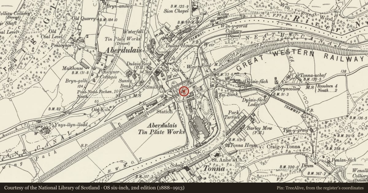
Slide toward Today to fade the historical sheet and see the modern map underneath.
David Rumsey Map Collection, Stanford LibrariesDavid Rumsey Map Collection, Stanford LibrariesDavid Rumsey Map Collection, Stanford LibrariesDavid Rumsey Map Collection, Stanford LibrariesDavid Rumsey Map Collection, Stanford Libraries
5 historical maps cover this location, the earliest the 1636 map "Cornubia : Devonia, Somersetus, Dorcestria, Wiltonia, Glocestria ..." (David Rumsey Map Collection, Stanford Libraries).
Historical maps covering this location
- 1636 · Cornubia : Devonia, Somersetus, Dorcestria, Wiltonia, Glocestria ... (David Rumsey Map Collection, Stanford Libraries)
- 1637 · The fourth table of England. Cornub. Devonia, Somerset etc. (David Rumsey Map Collection, Stanford Libraries)
- 1865 · England and Wales. England No. 6. (David Rumsey Map Collection, Stanford Libraries)
- 1891 · Sheet 10. Ordnance Survey of England and Wales. . (David Rumsey Map Collection, Stanford Libraries)
- 1897 · 247 Swansea (Hills) (David Rumsey Map Collection, Stanford Libraries)
Cadw's description
Location
Spanning the Afon Nedd S of the Aberdulais Aqueduct and N of Dulais Fach Road.
History
The Vale of Neath Railway was incorporated in 1846 and opened in 1851. Engineered by Isambard Kingdom Brunel, the line was built to a broad gauge. The Aberdulais viaduct, like many others designed by Brunel, was originally constructed of timber with stone abutments, with the intention of rebuilding in stone at a later date. In the event the bridge was not rebuilt in stone until the late C19, after it was absorbed into the GWR in 1861.
Exterior
Railway viaduct, 5-bays of which 4 span the River Neath, and a 5th bay on the W side spans Station Road. The abutments, belonging to the original bridge opened in 1851, are of coursed hammer-dressed sandstone, while the later arches and parapet are of snecked, rock-faced stone with blue-brick arches. The piers have V-shaped cutwaters with pyramidal caps. Beneath the parapet is a thick projecting blue-brick band. The flat coping is of large bricks. The abutments are battered (with a concave profile beneath the deck) and are splayed outwards to retain an embankment. The abutments also retain vertical slots which housed the original timberwork of Brunel's bridge. The deck carries a single track.
Reason for designation
Listed for its industrial archaeological interest as a railway bridge designed in 2 phases, the original wooden structure having been replaced by the present stone bridge but incorporating the original abutments. Group value with Aberdulais Aqueduct.
Nearby in the register
- Aberdulais AqueductAqueductunder 1 mi
- Aberdulais Aqueduct (partly in Blaenhonddan community)Communicationsunder 1 mi
- Aberdulais Viaduct (partly in Tonna community)Transportunder 1 mi
- Aberdulais Aqueduct (partly in Tonna community)Water Supply and Drainageunder 1 mi
Other entries of the same register within about three miles of this one, by straight line.