Cof Cymru: National Historic Assets of Wales · Wales
Ynys Coch Fach
Lledrod, Ceredigion, Wales
A Grade II listed building in Bronnant, Lledrod, Ceredigion, designated on 11 November 2003.
The record
- Designation
- Listed building, Grade II
- Broad class
- Domestic
- Date of designation
- 11 November 2003
- Locality
- Bronnant
- Community
- Lledrod
- Unitary authority
- Ceredigion
- Country
- Wales
- Coordinates
- 52.28368, -3.99344
- Cadw reference
- 82061
Slide toward Today to fade the historical sheet and see the modern map underneath.
David Rumsey Map Collection, Stanford LibrariesDavid Rumsey Map Collection, Stanford LibrariesDavid Rumsey Map Collection, Stanford LibrariesDavid Rumsey Map Collection, Stanford LibrariesDavid Rumsey Map Collection, Stanford Libraries
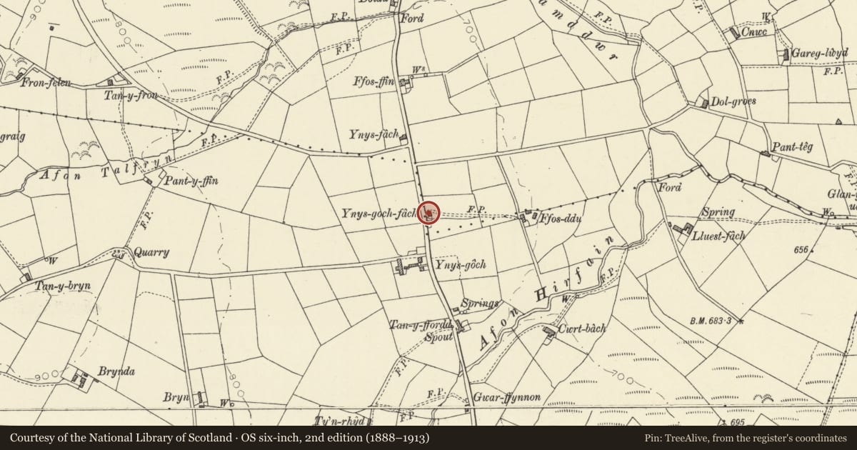
5 historical maps cover this location, the earliest the 1830 map "V.3:11-15:XV. Britisches Reich. A. Kon: England. b. Frstenthum Wales: Shire: 37-40" (David Rumsey Map Collection, Stanford Libraries).
Historical maps covering this location
- 1830 · V.3:11-15:XV. Britisches Reich. A. Kon: England. b. Frstenthum Wales: Shire: 37-40 (David Rumsey Map Collection, Stanford Libraries)
- 1896 · Sheet 7. Ordnance Survey of England and Wales. (David Rumsey Map Collection, Stanford Libraries)
- 1899 · 178 Llanilar (Hills) (David Rumsey Map Collection, Stanford Libraries)
- 1901 · Sheet 14. (David Rumsey Map Collection, Stanford Libraries)
- 1919 · Sheet 78. Lampeter. (David Rumsey Map Collection, Stanford Libraries)
Cadw's description
Location
Situated on the E side of the A485, some 100m S of the PO in Bronnant.
History
C19 roadside house not obviously marked on 1842 Blaenpennal Tithe map, perhaps mid C19.
Exterior
Detached house, whitewashed rubble stone with slate roof and stone end stacks. Two-storey, 3-window range, offset to left, upper floor with small 4-pane sashes with heads under eaves, ground floor with longer sashes, 4-pane to left and 2-pane to right, all with painted rough slate sills. Doorway under central window with plain board door and plain overlight. To left, altered single-storey rubble stone lean-to with doorway to right and small window adjacent, to left. Rubble stone back wall, no windows.
Interior
Not inspected at time of survey.
Reason for designation
Included as a good example of a smaller traditional house with facade offset for large kitchen chimney, of a type once common now generally altered.
Nearby in the register
- Cwrt Bach with attached outbuildingAgriculture and Subsistenceunder 1 mi
- Outbuilding at Mynydd BrithAgriculture and Subsistenceunder 1 mi
- Mynydd BrithDomesticunder 1 mi
- BronfynwentAgriculture and Subsistenceunder 1 mi
Other entries of the same register within about three miles of this one, by straight line.