Cof Cymru: National Historic Assets of Wales · Wales
Neuadd
Lledrod, Ceredigion, Wales
A Grade II listed building in Lledrod, Ceredigion, designated on 11 November 2003.
The record
- Designation
- Listed building, Grade II
- Broad class
- Agriculture and Subsistence
- Date of designation
- 11 November 2003
- Locality
- Lledrod
- Community
- Lledrod
- Unitary authority
- Ceredigion
- Country
- Wales
- Coordinates
- 52.31824, -3.99969
- Cadw reference
- 82057
Slide toward Today to fade the historical sheet and see the modern map underneath.
David Rumsey Map Collection, Stanford LibrariesDavid Rumsey Map Collection, Stanford LibrariesDavid Rumsey Map Collection, Stanford LibrariesDavid Rumsey Map Collection, Stanford LibrariesDavid Rumsey Map Collection, Stanford Libraries
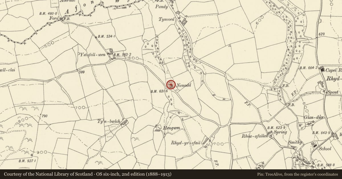
5 historical maps cover this location, the earliest the 1830 map "V.3:11-15:XV. Britisches Reich. A. Kon: England. b. Frstenthum Wales: Shire: 37-40" (David Rumsey Map Collection, Stanford Libraries).
Historical maps covering this location
- 1830 · V.3:11-15:XV. Britisches Reich. A. Kon: England. b. Frstenthum Wales: Shire: 37-40 (David Rumsey Map Collection, Stanford Libraries)
- 1883 · Watershed map England, Wales 3. (David Rumsey Map Collection, Stanford Libraries)
- 1896 · Sheet 7. Ordnance Survey of England and Wales. (David Rumsey Map Collection, Stanford Libraries)
- 1899 · 178 Llanilar (Hills) (David Rumsey Map Collection, Stanford Libraries)
- 1901 · Sheet 14. (David Rumsey Map Collection, Stanford Libraries)
Cadw's description
Location
Situated on the N side of a minor road, some 800m NW of the centre of Lledrod.
History
Early to mid C19 small farmhouse. Marked on 1843 tithe map as a house and garden on Tynycoed Farm, the farm owned by David Pierce Evans and tenanted by Thomas Rees.
Exterior
House, painted rubble stone with slate roof and painted stone end stacks with dripstones. Two storeys, double-fronted, offset to left. Small rooflight, 4-pane horned sashes, upper window heads at eaves level, stone voussoirs to lower openings and C20 door in corrugated iron porch. Rubble stone outbuilding to left with slate roof, the ridge sloping downhill, centre door with stone voussoirs. C20 garage to right.
Rear has rubble stone outshut to right extending half the length of the house with 2 roof lights and added brick lean-to abutting. Rear left has traces of whitewash and no windows.
Corrugated iron roofed lean-to at rear of outbuilding.
Interior
Not inspected at time of survey.
Reason for designation
Included as a little-altered smaller traditional farmhouse.
Nearby in the register
- Gaer FawrHillfortunder 1 mi
- Tanllain and attached outbuilding and forgeDomestic1 mi
- Caer ArgoedHillfort1 mi
- Ty'n-yr-Eithin Round CairnRound Cairn1 mi
Other entries of the same register within about three miles of this one, by straight line.