Cof Cymru: National Historic Assets of Wales · Wales
Lime kiln N of Pentre-Bach (partly in the Llantarnam community)
Llantarnam, Torfaen, Wales
A Grade II listed building in Pentre-Bach, Cwmbran, Llantarnam, Torfaen, designated on 30 September 2003.
The record
- Designation
- Listed building, Grade II
- Broad class
- Industrial
- Date of designation
- 30 September 2003
- Locality
- Pentre-Bach
- Town
- Cwmbran
- Community
- Llantarnam
- Unitary authority
- Torfaen
- Country
- Wales
- Coordinates
- 51.62487, -3.03374
- Cadw reference
- 82036
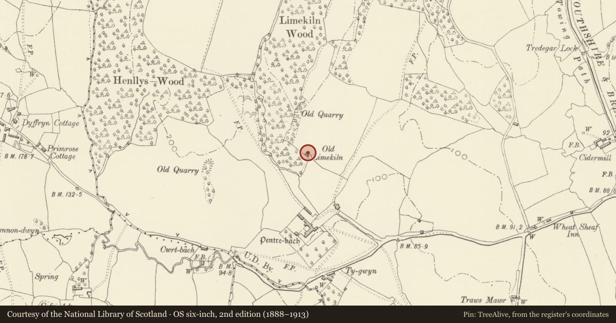
Slide toward Today to fade the historical sheet and see the modern map underneath.
David Rumsey Map Collection, Stanford LibrariesDavid Rumsey Map Collection, Stanford LibrariesDavid Rumsey Map Collection, Stanford LibrariesDavid Rumsey Map Collection, Stanford LibrariesDavid Rumsey Map Collection, Stanford Libraries
5 historical maps cover this location, the earliest the 1636 map "Cornubia : Devonia, Somersetus, Dorcestria, Wiltonia, Glocestria ..." (David Rumsey Map Collection, Stanford Libraries).
Historical maps covering this location
- 1636 · Cornubia : Devonia, Somersetus, Dorcestria, Wiltonia, Glocestria ... (David Rumsey Map Collection, Stanford Libraries)
- 1830 · V.3:11-15:XV.Britisches Reich. A. Kon: England. a. England ab sich: Shire:15-17, 33 (David Rumsey Map Collection, Stanford Libraries)
- 1895 · Sheet 11. Ordnance Survey of England and Wales. (David Rumsey Map Collection, Stanford Libraries)
- 1906 · 249 Newport (Hills) (David Rumsey Map Collection, Stanford Libraries)
- 1913 · Sheet 102. Newport. (David Rumsey Map Collection, Stanford Libraries)
Cadw's description
Location
Built into the hillside at the edge of field some 200m N of Pentre-Bach.
History
Early C19 lime kiln of the local Monmouthshire type, rectangular in plan with two kiln eyes.
Exterior
Lime kiln, rectangular plan, built into a bank at the edge of a field with walls of rubble stone and retaining walls splayed out each side. Two large kiln-eyes to the longer S side offset to E with wall stepped out on W end. Kiln-eyes have segmental arches with dressed stone voussoirs and central rubble stone pier. Crucible is open and brick lined but in deteriorating condition as is kiln-eye to E. The W retaining wall and central pier have been extended and the area roofed with iron sheets to form animal shelter.
Reason for designation
Included as the remains of a substantial lime-kiln, of industrial archaeological interest.
Nearby in the register
- Lime kiln to N of Pentre-Bach (partly in Cwmbran Central)No class recordedunder 1 mi
- Pentre-Bach and attached outbuildingsDomesticunder 1 mi
- Canal bridge at Tredegar Lock on Monmouthshire and Brecon CanalNo class recordedunder 1 mi
- Canal bridge at Drapers Lock on Monmouthshire and Brecon CanalNo class recordedunder 1 mi
Other entries of the same register within about three miles of this one, by straight line.