Cof Cymru: National Historic Assets of Wales · Wales
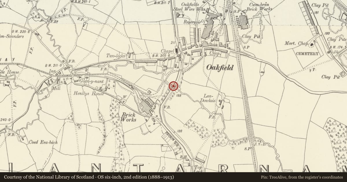
Aqueduct over Dowlais Brook on Monmouthshire and Brecon Canal (partly in the Llantarnam community)
Cwmbran Central, Torfaen, Wales
A Grade II listed building in Cwmbran, Cwmbran Central, Torfaen, designated on 30 September 2003.
The record
- Designation
- Listed building, Grade II
- Broad class
- Transport
- Date of designation
- 30 September 2003
- Locality
- Cwmbran
- Town
- Cwmbran
- Community
- Cwmbran Central
- Unitary authority
- Torfaen
- Country
- Wales
- Coordinates
- 51.64038, -3.02671
- Cadw reference
- 82035
Slide toward Today to fade the historical sheet and see the modern map underneath.
David Rumsey Map Collection, Stanford LibrariesDavid Rumsey Map Collection, Stanford LibrariesDavid Rumsey Map Collection, Stanford LibrariesDavid Rumsey Map Collection, Stanford LibrariesDavid Rumsey Map Collection, Stanford Libraries
5 historical maps cover this location, the earliest the 1636 map "Cornubia : Devonia, Somersetus, Dorcestria, Wiltonia, Glocestria ..." (David Rumsey Map Collection, Stanford Libraries).
Historical maps covering this location
- 1636 · Cornubia : Devonia, Somersetus, Dorcestria, Wiltonia, Glocestria ... (David Rumsey Map Collection, Stanford Libraries)
- 1830 · V.3:11-15:XV.Britisches Reich. A. Kon: England. a. England ab sich: Shire:15-17, 33 (David Rumsey Map Collection, Stanford Libraries)
- 1895 · Sheet 11. Ordnance Survey of England and Wales. (David Rumsey Map Collection, Stanford Libraries)
- 1906 · 249 Newport (Hills) (David Rumsey Map Collection, Stanford Libraries)
- 1913 · Sheet 102. Newport. (David Rumsey Map Collection, Stanford Libraries)
Cadw's description
Location
On the Monmouthshire and Brecon Canal some 200m S of Two Locks Road in Cwmbran.
History
Late C18 aqueduct carrying the Monmouthshire Canal over the Dowlais Brook. The Monmouthshire Canal which was a prime factor in the industrial development of the Gwent Valleys and was built by Thomas Dadford Junior, 1792-9. The canal ran between Newport and Pontnewynydd, with a branch between Crindau and Crumlin.
Exterior
Canal aqueduct over river, two tunnels of squared stone with segmental arched openings each side of canal. High stone embanking walls without parapets but with triangular piers on each side of and between tunnels. Piers have sloping tops and stop approximately 1m below top of wall. Abutments are splayed each side. Arches have stone voussoirs with raised keystones and walling is of squared stone laid in courses. River on downstream side is paved for some 6m with squared stone blocks terminating in low weir.
Reason for designation
Included a substantial masonry feature on an important late C18 canal which was a prime factor in the industrial development of the Gwent Valleys.
Nearby in the register
- Aqueduct over Dowlais Brook on Monmouthshire and Brecon Canal, partly in Cwmbran Central CommunityNo class recordedunder 1 mi
- Lime kiln on S side of Garth RoadIndustrialunder 1 mi
- Canal bridge at Top Lock on Monmouthshire and Brecon CanalNo class recordedunder 1 mi
- Glan-y-nant FarmDomesticunder 1 mi
Other entries of the same register within about three miles of this one, by straight line.