Cof Cymru: National Historic Assets of Wales · Wales
Pigsty and outside kitchen at Pen yr allt Isaf
Clynnog, Gwynedd, Wales
A Grade II listed building in Clynnog, Gwynedd, designated on 16 January 2004.
The record
- Designation
- Listed building, Grade II
- Broad class
- Agriculture and Subsistence
- Date of designation
- 16 January 2004
- Locality
- Clynnog
- Community
- Clynnog
- Unitary authority
- Gwynedd
- Country
- Wales
- Coordinates
- 53.01606, -4.36282
- Cadw reference
- 82033
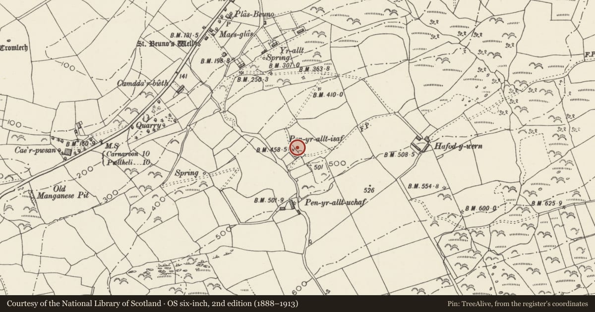
Slide toward Today to fade the historical sheet and see the modern map underneath.
David Rumsey Map Collection, Stanford LibrariesDavid Rumsey Map Collection, Stanford LibrariesDavid Rumsey Map Collection, Stanford LibrariesDavid Rumsey Map Collection, Stanford LibrariesLlyfrgell Genedlaethol Cymru – The National Library of Wales
5 historical maps cover this location, the earliest the 1795 map "To Sir Watkin Williams-Wynn Bart ... the map of the six counties of North Wales is most humbly inscribed by his obedient humble servant" (Llyfrgell Genedlaethol Cymru – The National Library of Wales).
Historical maps covering this location
- 1795 · To Sir Watkin Williams-Wynn Bart ... the map of the six counties of North Wales is most… (Llyfrgell Genedlaethol Cymru – The National Library of Wales)
- 1883 · Watershed map England, Wales 3. (David Rumsey Map Collection, Stanford Libraries)
- 1896 · Sheet 7. Ordnance Survey of England and Wales. (David Rumsey Map Collection, Stanford Libraries)
- 1899 · 118 Nevin (Hills) (David Rumsey Map Collection, Stanford Libraries)
- 1901 · Sheet 9 and 10. (David Rumsey Map Collection, Stanford Libraries)
Cadw's description
Location
Forms the eastern range of the yard at Pen yr allt Isaf.
History
The pigsty and outside kitchen belong with the late C19 estate-sponsored improvements on this upland small-holding.
Exterior
Rubble built with machine-cut slate roofs. The outside kitchen is to the left, with chimney on its upper gable end. Front wall has been opened out, perhaps for later use as cartshed. Pigsty alongside is of lean-to construction against the rear wall, with walled yards in front; unequally divided as two pens, a smaller to the left, that to right with slate lined feeding chute and trough in the front wall.
Reason for designation
Listed notwithstanding damaged condition of kitchen as an integral component of this exceptionally complete small planned farmstead.
Nearby in the register
- Pen yr allt IsafDomesticunder 1 mi
- Pen yr allt uchafAgriculture and Subsistenceunder 1 mi
- SW range of farm buildings at Hafod-y-wernAgriculture and Subsistenceunder 1 mi
- Piggery at Hafod-y-wernAgriculture and Subsistenceunder 1 mi
Other entries of the same register within about three miles of this one, by straight line.