Cof Cymru: National Historic Assets of Wales · Wales
Pigsty and brewhouse range at Gilfach Goch
Llanbedr, Gwynedd, Wales
A Grade II listed building in Llanbedr, Gwynedd, designated on 29 October 2003.
The record
- Designation
- Listed building, Grade II
- Broad class
- Agriculture and Subsistence
- Date of designation
- 29 October 2003
- Locality
- Llanbedr
- Community
- Llanbedr
- Unitary authority
- Gwynedd
- Country
- Wales
- Coordinates
- 52.81307, -4.09808
- Cadw reference
- 82010
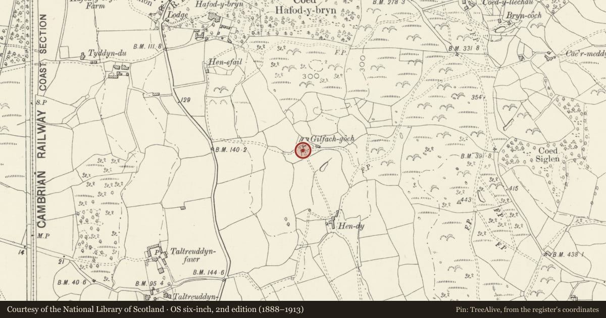
Slide toward Today to fade the historical sheet and see the modern map underneath.
David Rumsey Map Collection, Stanford LibrariesDavid Rumsey Map Collection, Stanford LibrariesDavid Rumsey Map Collection, Stanford LibrariesLlyfrgell Genedlaethol Cymru – The National Library of WalesDavid Rumsey Map Collection, Stanford Libraries
5 historical maps cover this location, the earliest the 1795 map "To Sir Watkin Williams-Wynn Bart ... the map of the six counties of North Wales is most humbly inscribed by his obedient humble servant" (Llyfrgell Genedlaethol Cymru – The National Library of Wales).
Historical maps covering this location
- 1795 · To Sir Watkin Williams-Wynn Bart ... the map of the six counties of North Wales is most… (Llyfrgell Genedlaethol Cymru – The National Library of Wales)
- 1883 · Watershed map England, Wales 3. (David Rumsey Map Collection, Stanford Libraries)
- 1896 · Sheet 7. Ordnance Survey of England and Wales. (David Rumsey Map Collection, Stanford Libraries)
- 1899 · 135 Harlech (Hills) (David Rumsey Map Collection, Stanford Libraries)
- 1901 · Sheet 9 and 10. (David Rumsey Map Collection, Stanford Libraries)
Cadw's description
Location
About 700m S of village. Above village reached via minor road and track. Built into hillside in sheltered position. The pigsties are to W of the house.
History
Late C18 or early C19 pigsty and brewhouse range.
Exterior
Single storey brewhouse with single unit pigsty to rear and walled yard to R (N). Built of coursed boulders; roof of small old slate with raking gable parapet to E, entrance, elevation and stone copings to opposite gable flanking a squat stone stack with dripstones and capping. The doorway is to the R (N) of the entrance elevation and has a small window to L. The entrance to the pigsty is in the N wall under a course of stones set at an angle; entrance to the yard is in the NE corner with stone lined feed chutes along the E wall.
Reason for designation
Listed as a well preserved brewhouse and pigsty range which forms a group with house and other agricultural buildings which together comprise a good example of a small rural farmstead.
Nearby in the register
- Gilfach GochAgriculture and Subsistenceunder 1 mi
- Agricultural range to rear of Gilfach GochAgriculture and Subsistenceunder 1 mi
- Lofted stable or cowhouse and cartshed range at Taltreuddyn-FawrNo class recordedunder 1 mi
- Barn at Taltreuddyn-FawrNo class recordedunder 1 mi
Other entries of the same register within about three miles of this one, by straight line.