Cof Cymru: National Historic Assets of Wales · Wales
Lofted cowhouse at Wern Gron
Llanbedr, Gwynedd, Wales
A Grade II listed building in Afon Artro Valley, Llanbedr, Gwynedd, designated on 29 October 2003.
The record
- Designation
- Listed building, Grade II
- Broad class
- Agriculture and Subsistence
- Date of designation
- 29 October 2003
- Locality
- Afon Artro Valley
- Community
- Llanbedr
- Unitary authority
- Gwynedd
- Country
- Wales
- Coordinates
- 52.83498, -4.06793
- Cadw reference
- 82003
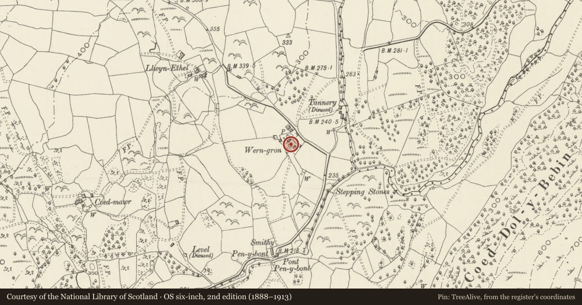
Slide toward Today to fade the historical sheet and see the modern map underneath.
David Rumsey Map Collection, Stanford LibrariesDavid Rumsey Map Collection, Stanford LibrariesDavid Rumsey Map Collection, Stanford LibrariesLlyfrgell Genedlaethol Cymru – The National Library of WalesDavid Rumsey Map Collection, Stanford Libraries
5 historical maps cover this location, the earliest the 1795 map "To Sir Watkin Williams-Wynn Bart ... the map of the six counties of North Wales is most humbly inscribed by his obedient humble servant" (Llyfrgell Genedlaethol Cymru – The National Library of Wales).
Historical maps covering this location
- 1795 · To Sir Watkin Williams-Wynn Bart ... the map of the six counties of North Wales is most… (Llyfrgell Genedlaethol Cymru – The National Library of Wales)
- 1883 · Watershed map England, Wales 3. (David Rumsey Map Collection, Stanford Libraries)
- 1896 · Sheet 7. Ordnance Survey of England and Wales. (David Rumsey Map Collection, Stanford Libraries)
- 1899 · 135 Harlech (Hills) (David Rumsey Map Collection, Stanford Libraries)
- 1901 · Sheet 9 and 10. (David Rumsey Map Collection, Stanford Libraries)
Cadw's description
Location
Set well back from the N side of a country road which leads along the W side of the Artro Valley, located to NNE of Pen y Bont. The cowhouse is to SE of the old farmhouse at Wern Gron.
History
Probably C18 agricultural range, re-roofed in C20.
Exterior
Lofted agricultural range of boulder construction; roof continues over aisle to rear giving asymmetrical profile - corrugated sheet roof but retaining stone copings. The principal elevation has a slightly advanced right hand bay that has a narrow door with loft opening above offset to L; main part has a doorway offset slightly to R with small window to its R and access to the loft via a doorway in the L gable.
Interior
The roof in the main part of the range retains roughly hewn chamfered collared trusses and the timber stalls and mangers remain.
Reason for designation
Included as a good and well preserved agricultural range which forms a group with the adjacent farmhouse at Wern Gron.
Nearby in the register
- Wern Gron FarmhouseDomesticunder 1 mi
- PenybontDomesticunder 1 mi
- Pont Pen-y-bontTransportunder 1 mi
- Coed MawrDomesticunder 1 mi
Other entries of the same register within about three miles of this one, by straight line.