Cof Cymru: National Historic Assets of Wales · Wales
Outbuilding to N of Vicarage
Llanilar, Ceredigion, Wales
A Grade II listed building in Llanilar, Ceredigion, designated on 27 October 2003.
The record
- Designation
- Listed building, Grade II
- Broad class
- Domestic
- Date of designation
- 27 October 2003
- Locality
- Llanilar
- Community
- Llanilar
- Unitary authority
- Ceredigion
- Country
- Wales
- Coordinates
- 52.35856, -4.02057
- Cadw reference
- 81978
Slide toward Today to fade the historical sheet and see the modern map underneath.
David Rumsey Map Collection, Stanford LibrariesDavid Rumsey Map Collection, Stanford LibrariesDavid Rumsey Map Collection, Stanford LibrariesDavid Rumsey Map Collection, Stanford LibrariesDavid Rumsey Map Collection, Stanford Libraries
5 historical maps cover this location, the earliest the 1830 map "V.3:11-15:XV. Britisches Reich. A. Kon: England. b. Frstenthum Wales: Shire: 37-40" (David Rumsey Map Collection, Stanford Libraries).
Historical maps covering this location
- 1830 · V.3:11-15:XV. Britisches Reich. A. Kon: England. b. Frstenthum Wales: Shire: 37-40 (David Rumsey Map Collection, Stanford Libraries)
- 1883 · Watershed map England, Wales 3. (David Rumsey Map Collection, Stanford Libraries)
- 1896 · Sheet 7. Ordnance Survey of England and Wales. (David Rumsey Map Collection, Stanford Libraries)
- 1899 · 178 Llanilar (Hills) (David Rumsey Map Collection, Stanford Libraries)
- 1901 · Sheet 14. (David Rumsey Map Collection, Stanford Libraries)
Cadw's description
Location
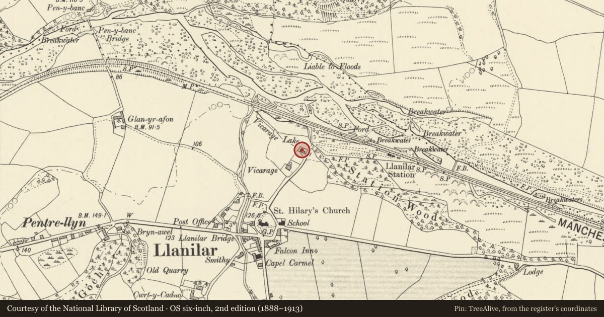
Situated some 70m NE of Vicarage at end of garden.
History
Small coach house and stable building, probably contemporary with the Vicarage of 1833 by George Clinton of Aberystwyth.
Exterior
Outbuilding, rubble stone with slate close-eaved roof. Two storeys, loft with square opening to left over ground floor door and window of former stable, both with stone voussoirs. To right is broad arched opening to coach-house with stone voussoirs to arch. Left end gable has blocked vent loop.
Reason for designation
Included as a small earlier C19 lofted coach house and stable, and for group value with the vicarage.
Nearby in the register
- The VicarageDomesticunder 1 mi
- Church of Saint IlarReligious, Ritual and Funeraryunder 1 mi
- Castle Hill Sculptured Stone (Moved into Llanilar Church)Inscribed Stoneunder 1 mi
- The Falcon InnNo class recordedunder 1 mi
Other entries of the same register within about three miles of this one, by straight line.