Cof Cymru: National Historic Assets of Wales · Wales
Castle Hill Lodge
Llanilar, Ceredigion, Wales
A Grade II listed building in Llanilar, Ceredigion, designated on 27 October 2003.
The record
- Designation
- Listed building, Grade II
- Broad class
- No class recorded
- Date of designation
- 27 October 2003
- Locality
- Llanilar
- Community
- Llanilar
- Unitary authority
- Ceredigion
- Country
- Wales
- Coordinates
- 52.35556, -4.01142
- Cadw reference
- 81966
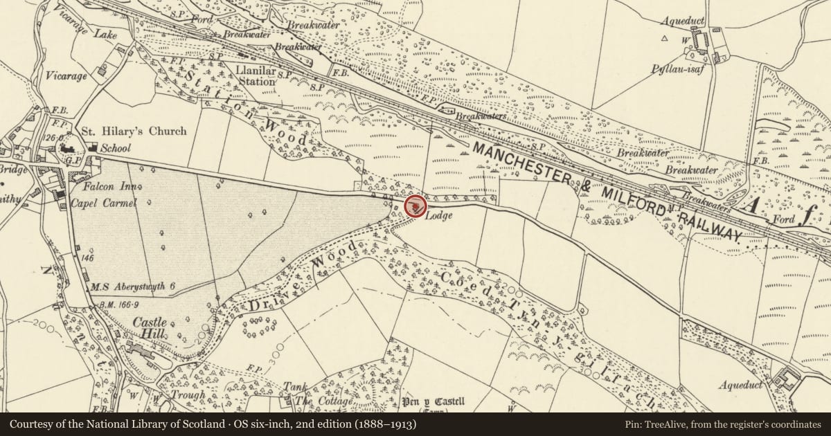
Slide toward Today to fade the historical sheet and see the modern map underneath.
David Rumsey Map Collection, Stanford LibrariesDavid Rumsey Map Collection, Stanford LibrariesDavid Rumsey Map Collection, Stanford LibrariesDavid Rumsey Map Collection, Stanford LibrariesDavid Rumsey Map Collection, Stanford Libraries
5 historical maps cover this location, the earliest the 1830 map "V.3:11-15:XV. Britisches Reich. A. Kon: England. b. Frstenthum Wales: Shire: 37-40" (David Rumsey Map Collection, Stanford Libraries).
Historical maps covering this location
- 1830 · V.3:11-15:XV. Britisches Reich. A. Kon: England. b. Frstenthum Wales: Shire: 37-40 (David Rumsey Map Collection, Stanford Libraries)
- 1883 · Watershed map England, Wales 3. (David Rumsey Map Collection, Stanford Libraries)
- 1896 · Sheet 7. Ordnance Survey of England and Wales. (David Rumsey Map Collection, Stanford Libraries)
- 1899 · 178 Llanilar (Hills) (David Rumsey Map Collection, Stanford Libraries)
- 1901 · Sheet 14. (David Rumsey Map Collection, Stanford Libraries)
Cadw's description
Location
Situated some 600m E of the village on S side of B4675 to Trawscoed.
History
Earlier C19 lodge to Castle Hill owned by the Williams family from 1777. Marked on 1844 Tithe map.
Exterior
Lodge, whitewashed rubble stone with slate half-hipped roof and centre whitewashed rubble chimney. One storey, double-fronted with hornless 4-pane sash each side of centre 4-panel door with sloping hood on plain brackets. Stone voussoirs to openings and slate sills. Right end wall has similar sash. Left end has lean-to and small C20 window above, under eaves. Rear has added matching wing to left, with roof hipped to W end, uPVC window to W and S sides. Rear door with sloping hood and small window each side.
Interior
Two-room plan with centre chimney, one bedroom in loft to left and one in added rear wing. Six-panel doors.
Reason for designation
Included as an attractive earlier C19 country estate lodge.
Nearby in the register
- Ty CnwcDomesticunder 1 mi
- Pen-y-Castell GroupHillfortunder 1 mi
- Gates, piers and railings to Plas LlidiardauDomesticunder 1 mi
- Castle HillDomesticunder 1 mi
Other entries of the same register within about three miles of this one, by straight line.