Cof Cymru: National Historic Assets of Wales · Wales
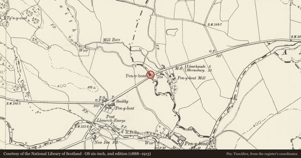
Bridge over Cynllaith at Pen-y-bont (Partly in the Civil Parish of Llanyblodwell, England)
Llangedwyn, Powys, Wales
A Grade II listed building in Pen-y-bont Llanerch Emrys, Llangedwyn, Powys, designated on 23 October 2003.
The record
- Designation
- Listed building, Grade II
- Broad class
- Transport
- Date of designation
- 23 October 2003
- Locality
- Pen-y-bont Llanerch Emrys
- Community
- Llangedwyn
- Unitary authority
- Powys
- Country
- Wales
- Coordinates
- 52.80672, -3.16671
- Cadw reference
- 81937
Slide toward Today to fade the historical sheet and see the modern map underneath.
David Rumsey Map Collection, Stanford LibrariesDavid Rumsey Map Collection, Stanford LibrariesDavid Rumsey Map Collection, Stanford LibrariesDavid Rumsey Map Collection, Stanford LibrariesLlyfrgell Genedlaethol Cymru – The National Library of Wales
5 historical maps cover this location, the earliest the 1795 map "To Sir Watkin Williams-Wynn Bart ... the map of the six counties of North Wales is most humbly inscribed by his obedient humble servant" (Llyfrgell Genedlaethol Cymru – The National Library of Wales).
Historical maps covering this location
- 1795 · To Sir Watkin Williams-Wynn Bart ... the map of the six counties of North Wales is most… (Llyfrgell Genedlaethol Cymru – The National Library of Wales)
- 1883 · Watershed map England, Wales 3. (David Rumsey Map Collection, Stanford Libraries)
- 1897 · 137 Oswestry (Hills) (David Rumsey Map Collection, Stanford Libraries)
- 1901 · Sheet 9 and 10. (David Rumsey Map Collection, Stanford Libraries)
- 1916 · Sheet 60. Shrewsbury. (David Rumsey Map Collection, Stanford Libraries)
Cadw's description
Location
Carrying the B4396 over the Cynllaith 300 m east of Pen-y-bont Inn.
History
Similarity to Pont Llanerchemrys identifies this as another by the same designer working for the Wynnstay estate, and probably at a similar early C19 date. It is marked on the Tithe Plan of 1841.
Exterior
A bridge of high segmental form spanning about 10 m in squared common masonry but with rusticated even-height voussoirs and a prominent keystone hanging from a string course at the base of the parapet. Similar both sides.
The bridge carriageway is about 6 m wide, with narrow orthostat sandstone parapets turning out at all four ends to small stone piers.
Reason for designation
A bridge showing estate influence in its design.
Nearby in the register
- Pont Llanerch Emrys (Partly in the Community of Llansantffraid)Transportunder 1 mi
- Pont Llanerch Emrys (Partly in the Community of Llangedwyn)Transportunder 1 mi
- Milestone at AbercynllaithTransportunder 1 mi
- Cowhouse Range at SycharthAgriculture and Subsistenceunder 1 mi
Other entries of the same register within about three miles of this one, by straight line.