Cof Cymru: National Historic Assets of Wales · Wales
Rhydleos
Llansilin, Powys, Wales
A Grade II listed building in Rhydleos, Llansilin, Powys, designated on 25 September 2003.
The record
- Designation
- Listed building, Grade II
- Broad class
- No class recorded
- Date of designation
- 25 September 2003
- Locality
- Rhydleos
- Community
- Llansilin
- Unitary authority
- Powys
- Country
- Wales
- Coordinates
- 52.86686, -3.17771
- Cadw reference
- 81916
Slide toward Today to fade the historical sheet and see the modern map underneath.
David Rumsey Map Collection, Stanford LibrariesDavid Rumsey Map Collection, Stanford LibrariesDavid Rumsey Map Collection, Stanford LibrariesLlyfrgell Genedlaethol Cymru – The National Library of WalesDavid Rumsey Map Collection, Stanford Libraries
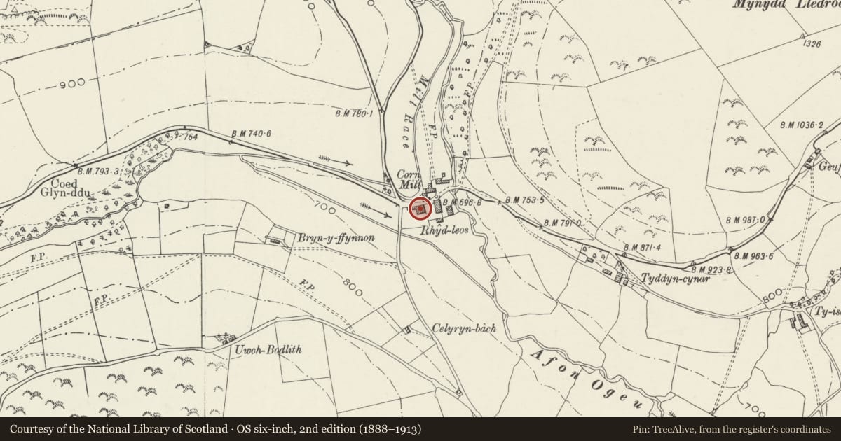
5 historical maps cover this location, the earliest the 1608 map "(13) Cambriae Typus." (David Rumsey Map Collection, Stanford Libraries).
Historical maps covering this location
- 1608 · (13) Cambriae Typus. (David Rumsey Map Collection, Stanford Libraries)
- 1795 · To Sir Watkin Williams-Wynn Bart ... the map of the six counties of North Wales is most… (Llyfrgell Genedlaethol Cymru – The National Library of Wales)
- 1883 · Watershed map England, Wales 3. (David Rumsey Map Collection, Stanford Libraries)
- 1897 · 137 Oswestry (Hills) (David Rumsey Map Collection, Stanford Libraries)
- 1901 · Sheet 9 and 10. (David Rumsey Map Collection, Stanford Libraries)
Cadw's description
Location
At the south side of the minor road from Llangadwaladr to Rhydycroesau in the Avon Ogau valley.
History
A small building is marked at this location in 1843, owned and occupied by Thomas Morris. This earlier building has been incorporated in the north-east corner of the present house (straight joints being discernable in the masonry of the north and east faces). It was a cottage or a large bakehouse, now surviving as a single room at ground level with a hearth and adjacent large bread oven, plus a room above at a floor level which is considerably lower than the remainder of the first floor of the house.
The house as enlarged in marked 'Erected by J and S Morris AD 1880' on a date-stone at each end. It is said to have been built by Morris of Llwynymaen for his daughter.
Exterior
A house of three-storeys and a basement in uncoursed local shaley stone. The tops of the walls consist of about four courses of red brick. The front of the house is in similar red brick, block-bonded at the corners into the stonework. Double hipped slate roof.
The front (to south) is a symmetrical three-window elevation with small-pane windows in diminishing heights vertically aligned. The ground storey windows are of sash type; the first storey windows comprise a sash window and two cross windows; the second storey windows are three-light casement windows. Small arched doorway at centre with unusually narrow double doors.
The side windows to left and right are a mixture of 16-pane sash windows and small-pane windows in block-bonded freestone surrounds with arched heads and stone sills. The rear windows are small, some are small pane casements, some four-pane sash windows.
Interior
The layout of the enlarged house is a difficult compromise between the evidently intended symmetrical planning and the restrictions caused by the decision to retain the smaller earlier building. Because the chimney of the earlier building occupies the space where the stairs would be expected, the stairs have been placed forward and the main front door opens directly onto them. In consequence the main doors are double and very small. This main staircase rises to the first floor only and has an unusually steep pitch; the second storey of the main part of the house is reached by a confined secondary staircase located to one side. Other stairs serve the kitchen (the incorporated earlier building) and its upper storey, and another short flight rises from this earlier upper storey to the general upper floor of the enlarged house.
The cellar belongs to the enlarged house, and has windows to the west side.
Reason for designation
A large C19 house of traditional design which has retained its character, dominating the Afon Ogau valley.
Nearby in the register
- Tyddyn CynarDomesticunder 1 mi
- Former Separate Kitchen or Bakehouse at Tyddyn CynarDomesticunder 1 mi
- YsgwennantDomesticunder 1 mi
- Ty-mawrAgriculture and Subsistenceunder 1 mi
Other entries of the same register within about three miles of this one, by straight line.