Cof Cymru: National Historic Assets of Wales · Wales
Bryn Awel
Llandrillo, Denbighshire, Wales
A Grade II listed building in Llechwedd Cilan, Llandrillo, Denbighshire, designated on 3 October 2003.
The record
- Designation
- Listed building, Grade II
- Broad class
- Domestic
- Date of designation
- 3 October 2003
- Locality
- Llechwedd Cilan
- Community
- Llandrillo
- Unitary authority
- Denbighshire
- Country
- Wales
- Coordinates
- 52.91946, -3.45762
- Cadw reference
- 81879
Slide toward Today to fade the historical sheet and see the modern map underneath.
David Rumsey Map Collection, Stanford LibrariesLlyfrgell Genedlaethol Cymru – The National Library of WalesDavid Rumsey Map Collection, Stanford LibrariesDavid Rumsey Map Collection, Stanford LibrariesDavid Rumsey Map Collection, Stanford Libraries
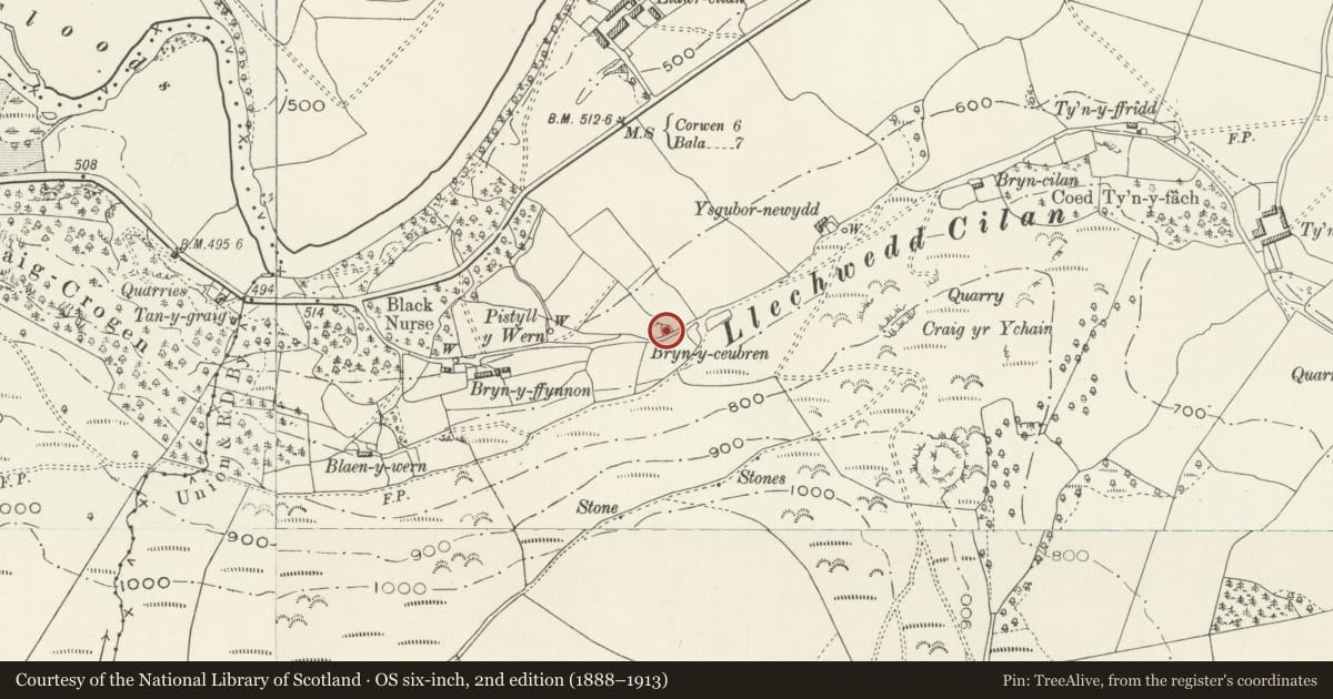
5 historical maps cover this location, the earliest the 1608 map "(13) Cambriae Typus." (David Rumsey Map Collection, Stanford Libraries).
Historical maps covering this location
- 1608 · (13) Cambriae Typus. (David Rumsey Map Collection, Stanford Libraries)
- 1795 · To Sir Watkin Williams-Wynn Bart ... the map of the six counties of North Wales is most… (Llyfrgell Genedlaethol Cymru – The National Library of Wales)
- 1830 · V.3:11-15:XV. Britisches Reich. A. Kon: England. b. Frstenthum Wales: Shire: 37-40 (David Rumsey Map Collection, Stanford Libraries)
- 1883 · Watershed map England, Wales 3. (David Rumsey Map Collection, Stanford Libraries)
- 1901 · Sheet 9 and 10. (David Rumsey Map Collection, Stanford Libraries)
Cadw's description
Location
On a narrow lane which runs along the hillside, parallel with and S of the B4401. The front faces N, away from the road, with fine views over the Dee valley.
History
Mentioned in the 1851 census, but not shown on the tithe map of 1843. On the 1891 Ordnance Survey, it is named Bryn y ceubren. It is likely that the cottage was built as an incursion on common land, a relatively late example of this phenomenon, and was built in a traditional style.
Exterior
Small 1-unit cottage, single-storey with attic, constructed of white-washed rubble stone under a slate roof with stone end stack to L. The front has a doorway to R with flat head containing split doors. Narrow single-light wooden casement with flat head to its L, above which is a raked half-dormer containing a 2-light wooden casement with large panes. W gable end has 2-light wooden casement. Integral rear lean-to with skylight to roof pitch, 2-light wooden casement to E and small light to W side.
Interior
No access to interior at time of inspection.
Reason for designation
Listed as a good example of a small squatter-type cottage built in a traditional style and retaining its character.
Nearby in the register
- Craig yr UchainEnclosureunder 1 mi
- Cart-shed and Stables to SW of Llawr Cilan FarmhouseAgriculture and Subsistenceunder 1 mi
- Llawr Cilan FarmhouseDomesticunder 1 mi
- Cow-house and adjoining Cart-shed to N of Llawr Cilan FarmhouseAgriculture and Subsistenceunder 1 mi
Other entries of the same register within about three miles of this one, by straight line.