Cof Cymru: National Historic Assets of Wales · Wales
1 Berwyn House
Llandrillo, Denbighshire, Wales
A Grade II listed building in Llandrillo, Denbighshire, designated on 3 October 2003.
The record
- Designation
- Listed building, Grade II
- Broad class
- Domestic
- Date of designation
- 3 October 2003
- Locality
- Llandrillo
- Community
- Llandrillo
- Unitary authority
- Denbighshire
- Country
- Wales
- Coordinates
- 52.92243, -3.43832
- Cadw reference
- 81875
Slide toward Today to fade the historical sheet and see the modern map underneath.
David Rumsey Map Collection, Stanford LibrariesDavid Rumsey Map Collection, Stanford LibrariesLlyfrgell Genedlaethol Cymru – The National Library of WalesDavid Rumsey Map Collection, Stanford LibrariesDavid Rumsey Map Collection, Stanford Libraries
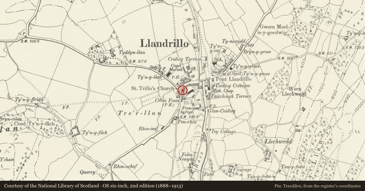
5 historical maps cover this location, the earliest the 1795 map "To Sir Watkin Williams-Wynn Bart ... the map of the six counties of North Wales is most humbly inscribed by his obedient humble servant" (Llyfrgell Genedlaethol Cymru – The National Library of Wales).
Historical maps covering this location
- 1795 · To Sir Watkin Williams-Wynn Bart ... the map of the six counties of North Wales is most… (Llyfrgell Genedlaethol Cymru – The National Library of Wales)
- 1830 · V.3:11-15:XV. Britisches Reich. A. Kon: England. b. Frstenthum Wales: Shire: 37-40 (David Rumsey Map Collection, Stanford Libraries)
- 1883 · Watershed map England, Wales 3. (David Rumsey Map Collection, Stanford Libraries)
- 1898 · 120 Corwen (Hills) (David Rumsey Map Collection, Stanford Libraries)
- 1901 · Sheet 9 and 10. (David Rumsey Map Collection, Stanford Libraries)
Cadw's description
Location
Facing a road junction towards the W of the village, and backing onto the W side of the churchyard.
History
Probably early C19 and shown on the tithe map of 1843. The cottages were remodelled in the late C19 with new doors and windows, the stacks c1900. This makes an interesting contrast with other cottages in the village which were not altered at this time.
Exterior
No 1 is larger than no 2 and has doorway to R and window to L, the upper storey windows aligned above. Original external stone stack visible to N gable end. Upper storey of rear has 2 x 4-pane horned sash windows to R, that to R wider; sash window with stained glass, probably stairlight to far L. Lower storey not seen.
Interior
No access to interior at time of inspection.
Reason for designation
Listed as a well-preserved unaltered cottage exhitibing strong C19 character. Group value with no 2 and other listed buildings in the Conservation Area.
Nearby in the register
- 2 Berwyn HouseDomesticunder 1 mi
- Entrance gates and piers to Church of St TrilloReligious, Ritual and Funeraryunder 1 mi
- The Bell InnDomesticunder 1 mi
- 4 High StreetDomesticunder 1 mi
Other entries of the same register within about three miles of this one, by straight line.