Cof Cymru: National Historic Assets of Wales · Wales
Maesgwyn
Llanrhaeadr-ym-Mochnant, Powys, Wales
A Grade II listed building in Llanrhaeadr-ym-Mochnant village, Llanrhaeadr-ym-Mochnant, Powys, designated on 29 August 2003.
The record
- Designation
- Listed building, Grade II
- Broad class
- Domestic
- Date of designation
- 29 August 2003
- Locality
- Llanrhaeadr-ym-Mochnant village
- Community
- Llanrhaeadr-ym-Mochnant
- Unitary authority
- Powys
- Country
- Wales
- Coordinates
- 52.82496, -3.30225
- Cadw reference
- 81828
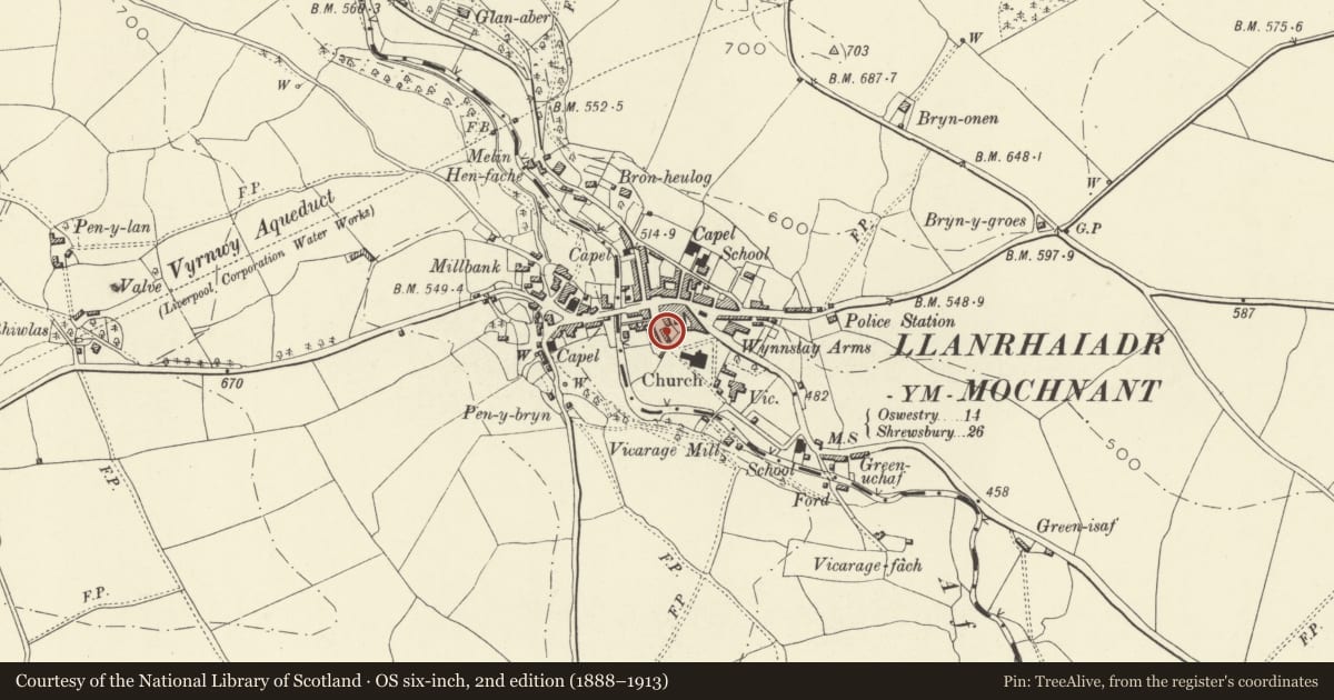
Slide toward Today to fade the historical sheet and see the modern map underneath.
David Rumsey Map Collection, Stanford LibrariesDavid Rumsey Map Collection, Stanford LibrariesDavid Rumsey Map Collection, Stanford LibrariesLlyfrgell Genedlaethol Cymru – The National Library of WalesDavid Rumsey Map Collection, Stanford Libraries
5 historical maps cover this location, the earliest the 1795 map "To Sir Watkin Williams-Wynn Bart ... the map of the six counties of North Wales is most humbly inscribed by his obedient humble servant" (Llyfrgell Genedlaethol Cymru – The National Library of Wales).
Historical maps covering this location
- 1795 · To Sir Watkin Williams-Wynn Bart ... the map of the six counties of North Wales is most… (Llyfrgell Genedlaethol Cymru – The National Library of Wales)
- 1883 · Watershed map England, Wales 3. (David Rumsey Map Collection, Stanford Libraries)
- 1897 · 137 Oswestry (Hills) (David Rumsey Map Collection, Stanford Libraries)
- 1901 · Sheet 9 and 10. (David Rumsey Map Collection, Stanford Libraries)
- 1916 · Sheet 60. Shrewsbury. (David Rumsey Map Collection, Stanford Libraries)
Cadw's description
Location
At the east side of Church Street, where it narrows to a footpath. Maesgwyn forms the south termination of the wide part of the street.
History
Late C18 or early C19. Marked on the Tithe Survey (1839) as house and garden owned by John Davies, occupied by Henry Vaughan. The front of the house was rebuilt in the mid C19.
Exterior
A two-storey house in local brown shaley stone facing north to Church Street. Later lean-to and small yard at rear. The front of the house has been considerably reconstructed in similar materials: it is now a three-window range, with brick arches and double-course sills to the front window openings, a restored slate roof with tile ridge and red-brick end chimneys, and a central semi-glazed door within a lightly constructed open-fronted porch. The sashes of the front windows are single-paned but with margin panes at the sides.
At rear and at gable ends the house has been painted white. At rear there are two small C18 or early C19 windows against eaves with small-pane glazing and wrought-iron stays. Similar small-pane window at ground storey in the side elevation to the street.
Reason for designation
A small house probably of C18 origin retaining some original detailing but with strong architectural character from C19 remodelling. Listed also for group value as part of a group including Minafon, Enson House, Hanmer House and Haulfre.
Nearby in the register
- Enson House including railings at frontDomesticunder 1 mi
- Hanmer House including railings at frontDomesticunder 1 mi
- MinafonDomesticunder 1 mi
- Haulfre Cottage and Shop ('Dragons') including railings at front.Commercialunder 1 mi
Other entries of the same register within about three miles of this one, by straight line.