Cof Cymru: National Historic Assets of Wales · Wales
10 Park Street including railings at front
Llanrhaeadr-ym-Mochnant, Powys, Wales
A Grade II listed building in Llanrhaeadr-ym-Mochnant village, Llanrhaeadr-ym-Mochnant, Powys, designated on 29 August 2003.
The record
- Designation
- Listed building, Grade II
- Broad class
- Domestic
- Date of designation
- 29 August 2003
- Locality
- Llanrhaeadr-ym-Mochnant village
- Community
- Llanrhaeadr-ym-Mochnant
- Unitary authority
- Powys
- Country
- Wales
- Coordinates
- 52.82516, -3.29987
- Cadw reference
- 81809
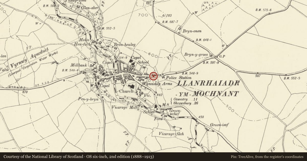
Slide toward Today to fade the historical sheet and see the modern map underneath.
David Rumsey Map Collection, Stanford LibrariesDavid Rumsey Map Collection, Stanford LibrariesDavid Rumsey Map Collection, Stanford LibrariesLlyfrgell Genedlaethol Cymru – The National Library of WalesDavid Rumsey Map Collection, Stanford Libraries
5 historical maps cover this location, the earliest the 1795 map "To Sir Watkin Williams-Wynn Bart ... the map of the six counties of North Wales is most humbly inscribed by his obedient humble servant" (Llyfrgell Genedlaethol Cymru – The National Library of Wales).
Historical maps covering this location
- 1795 · To Sir Watkin Williams-Wynn Bart ... the map of the six counties of North Wales is most… (Llyfrgell Genedlaethol Cymru – The National Library of Wales)
- 1883 · Watershed map England, Wales 3. (David Rumsey Map Collection, Stanford Libraries)
- 1897 · 137 Oswestry (Hills) (David Rumsey Map Collection, Stanford Libraries)
- 1901 · Sheet 9 and 10. (David Rumsey Map Collection, Stanford Libraries)
- 1916 · Sheet 60. Shrewsbury. (David Rumsey Map Collection, Stanford Libraries)
Cadw's description
Location
At the north side of Park Street, about 250 m east of the bridge.
History
Four cottages built in 1834. Marked on the Tithe Survey (1839) as four cottages owned by William Evans (the same name appearing on the date-stone).
Reason for designation
One of four minor vernacular local stone cottages in a dated terrace of William IV date, of strong character and retaining simple early detail; listed also for group value.
Nearby in the register
- 9 Park Street including railings at frontDomesticunder 1 mi
- 8 Park Street including railings at frontDomesticunder 1 mi
- 7 Park Street including railings at frontDomesticunder 1 mi
- Trigfan (including building at the rear of Y Bwthyn)Domesticunder 1 mi
Other entries of the same register within about three miles of this one, by straight line.