Cof Cymru: National Historic Assets of Wales · Wales
The Cottage
Graig, Newport, Wales
A Grade II listed building in Bassaleg, Newport, Graig, designated on 22 August 2003.
The record
- Designation
- Listed building, Grade II
- Broad class
- No class recorded
- Date of designation
- 22 August 2003
- Locality
- Bassaleg
- Town
- Newport
- Community
- Graig
- Unitary authority
- Newport
- Country
- Wales
- Coordinates
- 51.57764, -3.04560
- Cadw reference
- 81803
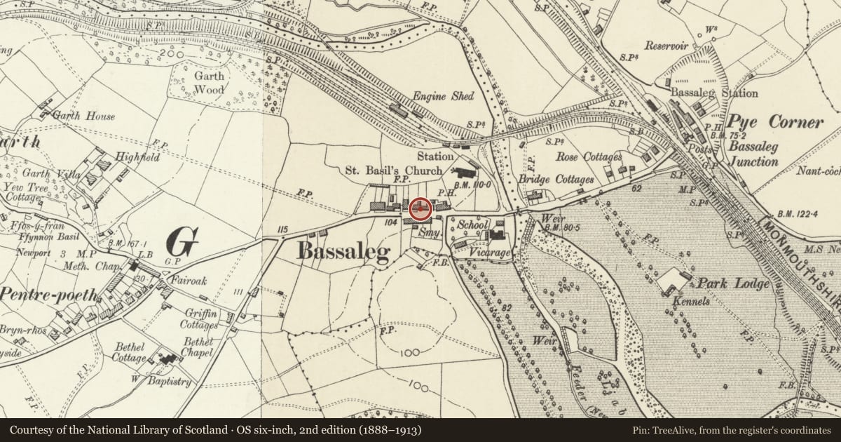
Slide toward Today to fade the historical sheet and see the modern map underneath.
David Rumsey Map Collection, Stanford LibrariesDavid Rumsey Map Collection, Stanford LibrariesDavid Rumsey Map Collection, Stanford LibrariesDavid Rumsey Map Collection, Stanford LibrariesDavid Rumsey Map Collection, Stanford Libraries
5 historical maps cover this location, the earliest the 1636 map "Cornubia : Devonia, Somersetus, Dorcestria, Wiltonia, Glocestria ..." (David Rumsey Map Collection, Stanford Libraries).
Historical maps covering this location
- 1636 · Cornubia : Devonia, Somersetus, Dorcestria, Wiltonia, Glocestria ... (David Rumsey Map Collection, Stanford Libraries)
- 1865 · England and Wales. England No. 6. (David Rumsey Map Collection, Stanford Libraries)
- 1895 · Sheet 11. Ordnance Survey of England and Wales. (David Rumsey Map Collection, Stanford Libraries)
- 1906 · 249 Newport (Hills) (David Rumsey Map Collection, Stanford Libraries)
- 1913 · Sheet 102. Newport. (David Rumsey Map Collection, Stanford Libraries)
Cadw's description
Location
Sitauted some 35m W of the Tredegar Arms on the N side of Caerphilly Road in Bassaleg.
History
C19 village house possibly associated with the Tredegar Arms Inn, and presumably built for the Tredegar estate, as it is attached to the coach-house of the inn and has similar hoodmoulds to windows.
Exterior
House, painted roughcast with slate deep-eaved roof and red brick end stacks. Two storeys, double fronted, cambered headed windows with hoodmoulds and renewed cross windows. Slate sills. Centre porch with fishscale slates and ashlar ridge tiles and finial and bargeboards. Tudor arched entry with hoodmould, inner square-headed panelled door, of 5 panels, one glazed. Gable verges have brackets. Rear additions to ground floor, dormer in roof.
Interior
Not inspected.
Reason for designation
Included as good mid C19 village house with Tudor detail, of group value with attached coach house of Tredegar Arms Inn.
Nearby in the register
- Coach House to W of the Tredegar Arms InnNo class recordedunder 1 mi
- Tower at SW corner of churchyard, attached to Tredegar ArmsNo class recordedunder 1 mi
- Lychgate, churchyard walls and railings to Church of Saint BasilNo class recordedunder 1 mi
- Church of Saint BasilReligious, Ritual and Funeraryunder 1 mi
Other entries of the same register within about three miles of this one, by straight line.