Cof Cymru: National Historic Assets of Wales · Wales
Old barn at Brynaber farmyard
Llanrhaeadr-ym-Mochnant, Powys, Wales
A Grade II listed building in Brynaber, Llanrhaeadr-ym-Mochnant, Powys, designated on 14 August 2003.
The record
- Designation
- Listed building, Grade II
- Broad class
- Agriculture and Subsistence
- Date of designation
- 14 August 2003
- Locality
- Brynaber
- Community
- Llanrhaeadr-ym-Mochnant
- Unitary authority
- Powys
- Country
- Wales
- Coordinates
- 52.80789, -3.32119
- Cadw reference
- 81782
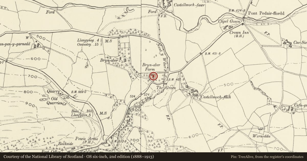
Slide toward Today to fade the historical sheet and see the modern map underneath.
David Rumsey Map Collection, Stanford LibrariesDavid Rumsey Map Collection, Stanford LibrariesDavid Rumsey Map Collection, Stanford LibrariesLlyfrgell Genedlaethol Cymru – The National Library of WalesDavid Rumsey Map Collection, Stanford Libraries
5 historical maps cover this location, the earliest the 1795 map "To Sir Watkin Williams-Wynn Bart ... the map of the six counties of North Wales is most humbly inscribed by his obedient humble servant" (Llyfrgell Genedlaethol Cymru – The National Library of Wales).
Historical maps covering this location
- 1795 · To Sir Watkin Williams-Wynn Bart ... the map of the six counties of North Wales is most… (Llyfrgell Genedlaethol Cymru – The National Library of Wales)
- 1883 · Watershed map England, Wales 3. (David Rumsey Map Collection, Stanford Libraries)
- 1897 · 137 Oswestry (Hills) (David Rumsey Map Collection, Stanford Libraries)
- 1901 · Sheet 9 and 10. (David Rumsey Map Collection, Stanford Libraries)
- 1916 · Sheet 60. Shrewsbury. (David Rumsey Map Collection, Stanford Libraries)
Cadw's description
Location
At the east side of the main farmyard of Brynaber farm.
History
Probably C18, contemporary with the farmhouse. Now used as a cattle shelter.
Exterior
A four-bay barn range. Local slatey quasi-rubble masonry with a low-pitch roof of small random slates with a tile ridge.
At front, facing the farmyard, the main barn doorway has been heightened to eaves level. A cartshed opening in the right bay has double boarded doors and a red-brick arch of elliptical form in common bricks. Above there are two loft hatches to the right of the barn door and two blocked openings to the left. Steps against the right gable up to the loft door; the door is boarded and has a brick segmental arch.
This range is linked by the north wall of the yard (against which later monopitch brick sheds stand) with the sheds range.
Reason for designation
Listed as an integral part of a set of farm buildings based on a listed farmhouse.
Nearby in the register
- Shed range at Brynaber farmyardAgriculture and Subsistenceunder 1 mi
- Lofted sheds at Brynaber farmyardAgriculture and Subsistenceunder 1 mi
- Brynaber farmhouseAgriculture and Subsistenceunder 1 mi
- Bryn Aber HallDomesticunder 1 mi
Other entries of the same register within about three miles of this one, by straight line.