Cof Cymru: National Historic Assets of Wales · Wales
Gethin Tramway Bridge
Troed-y-Rhiw, Merthyr Tydfil, Wales
A Grade II listed building in Abercanaid, Troed-y-Rhiw, Merthyr Tydfil, designated on 29 July 2003.
The record
- Designation
- Listed building, Grade II
- Broad class
- Transport
- Date of designation
- 29 July 2003
- Locality
- Abercanaid
- Community
- Troed-y-Rhiw
- Unitary authority
- Merthyr Tydfil
- Country
- Wales
- Coordinates
- 51.72114, -3.36524
- Cadw reference
- 81751
Slide toward Today to fade the historical sheet and see the modern map underneath.
David Rumsey Map Collection, Stanford LibrariesDavid Rumsey Map Collection, Stanford LibrariesDavid Rumsey Map Collection, Stanford LibrariesDavid Rumsey Map Collection, Stanford LibrariesDavid Rumsey Map Collection, Stanford Libraries
5 historical maps cover this location, the earliest the 1636 map "Cornubia : Devonia, Somersetus, Dorcestria, Wiltonia, Glocestria ..." (David Rumsey Map Collection, Stanford Libraries).
Historical maps covering this location
- 1636 · Cornubia : Devonia, Somersetus, Dorcestria, Wiltonia, Glocestria ... (David Rumsey Map Collection, Stanford Libraries)
- 1637 · The fourth table of England. Cornub. Devonia, Somerset etc. (David Rumsey Map Collection, Stanford Libraries)
- 1865 · England and Wales. England No. 6. (David Rumsey Map Collection, Stanford Libraries)
- 1895 · Sheet 11. Ordnance Survey of England and Wales. (David Rumsey Map Collection, Stanford Libraries)
- 1898 · 231 Merthyr Tydfil (Hills) (David Rumsey Map Collection, Stanford Libraries)
Cadw's description
Location
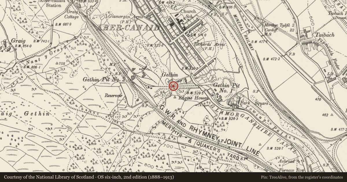
Situated at Gethin on the S side of Abercanaid just W of the former Glamorganshire canal.
History
Mid C19 tramway bridge to enable access for Gethin farm to its land, under the Gethin tramway incline. The tramway, built c1846/49, connected the two Crawshay collieries, Gethin No. 1 Pit (Lower Gethin) and Gethin No. 2 Pit. It permitted coal from either to be taken direct to Cyfarthfa Works (via No. 2 Pit) or via the Glamorganshire canal from the dock alongside No. 1 Pit.
Exterior
Narrow bridge with tall narrow arch (2.3m high, 2.9m wide and 9.9m deep), of rock-faced rubble stone with stringcourse over. Tall masonry revetment to side of sloping tramroad. No parapets.
Reason for designation
Included as a well-preserved tramroad bridge of industrial archaeological interest, a now rare example of tramroad engineering in the region.
Nearby in the register
- Sion Independent ChapelReligious, Ritual and Funeraryunder 1 mi
- 72 Nightingale StreetDomesticunder 1 mi
- 12 Nightingale StreetDomesticunder 1 mi
- 71 Nightingale StreetDomesticunder 1 mi
Other entries of the same register within about three miles of this one, by straight line.