Cof Cymru: National Historic Assets of Wales · Wales
6 River Row
Troed-y-Rhiw, Merthyr Tydfil, Wales
A Grade II listed building in Abercanaid, Troed-y-Rhiw, Merthyr Tydfil, designated on 22 August 1975.
The record
- Designation
- Listed building, Grade II
- Broad class
- Domestic
- Date of designation
- 22 August 1975
- Locality
- Abercanaid
- Community
- Troed-y-Rhiw
- Unitary authority
- Merthyr Tydfil
- Country
- Wales
- Coordinates
- 51.72511, -3.36671
- Cadw reference
- 81728
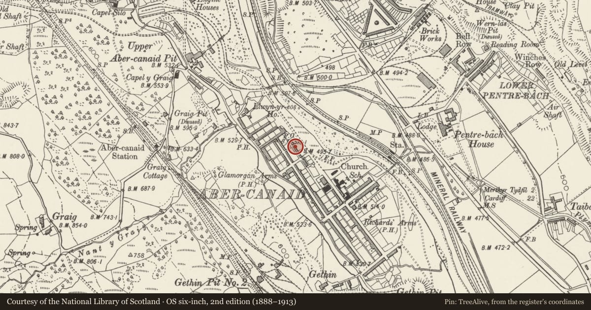
Slide toward Today to fade the historical sheet and see the modern map underneath.
David Rumsey Map Collection, Stanford LibrariesDavid Rumsey Map Collection, Stanford LibrariesDavid Rumsey Map Collection, Stanford LibrariesDavid Rumsey Map Collection, Stanford LibrariesDavid Rumsey Map Collection, Stanford Libraries
5 historical maps cover this location, the earliest the 1636 map "Cornubia : Devonia, Somersetus, Dorcestria, Wiltonia, Glocestria ..." (David Rumsey Map Collection, Stanford Libraries).
Historical maps covering this location
- 1636 · Cornubia : Devonia, Somersetus, Dorcestria, Wiltonia, Glocestria ... (David Rumsey Map Collection, Stanford Libraries)
- 1637 · The fourth table of England. Cornub. Devonia, Somerset etc. (David Rumsey Map Collection, Stanford Libraries)
- 1865 · England and Wales. England No. 6. (David Rumsey Map Collection, Stanford Libraries)
- 1895 · Sheet 11. Ordnance Survey of England and Wales. (David Rumsey Map Collection, Stanford Libraries)
- 1898 · 231 Merthyr Tydfil (Hills) (David Rumsey Map Collection, Stanford Libraries)
Cadw's description
Location
Situated on the NE side of Abercanaid facing the Afon Taf.
Exterior
(End terrace house) No 6 has C20 plate-glass sash windows and C20 door with overlight, no chimneys, and rubble stone right end and rear walls, blocked rear door.
Interior
Not inspected.
Reason for designation
Included as one of the best surviving groups of early industrial workers' housing in the region.
Nearby in the register
- 5 River RowDomesticunder 1 mi
- 4 River RowDomesticunder 1 mi
- 3 River RowDomesticunder 1 mi
- 2 River RowDomesticunder 1 mi
Other entries of the same register within about three miles of this one, by straight line.