Cof Cymru: National Historic Assets of Wales · Wales
Corbelled pigsty at Penddeugae Fach
Troed-y-Rhiw, Merthyr Tydfil, Wales
A Grade II listed building in Troed-y-rhiw, Merthyr Tydfil, designated on 29 July 2003.
The record
- Designation
- Listed building, Grade II
- Broad class
- Agriculture and Subsistence
- Date of designation
- 29 July 2003
- Locality
- Troed-y-rhiw
- Community
- Troed-y-Rhiw
- Unitary authority
- Merthyr Tydfil
- Country
- Wales
- Coordinates
- 51.70439, -3.33060
- Cadw reference
- 81723
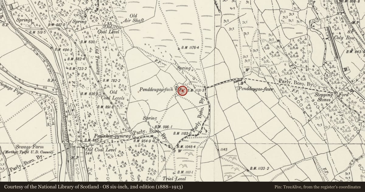
Slide toward Today to fade the historical sheet and see the modern map underneath.
David Rumsey Map Collection, Stanford LibrariesNational Library of ScotlandDavid Rumsey Map Collection, Stanford LibrariesDavid Rumsey Map Collection, Stanford LibrariesDavid Rumsey Map Collection, Stanford Libraries
5 historical maps cover this location, the earliest the 1636 map "Cornubia : Devonia, Somersetus, Dorcestria, Wiltonia, Glocestria ..." (David Rumsey Map Collection, Stanford Libraries).
Historical maps covering this location
- 1636 · Cornubia : Devonia, Somersetus, Dorcestria, Wiltonia, Glocestria ... (David Rumsey Map Collection, Stanford Libraries)
- 1637 · The fourth table of England. Cornub. Devonia, Somerset etc. (David Rumsey Map Collection, Stanford Libraries)
- 1865 · England and Wales. England No. 6. (David Rumsey Map Collection, Stanford Libraries)
- 1895 · Sheet 11. Ordnance Survey of England and Wales. (David Rumsey Map Collection, Stanford Libraries)
- 1954 · SO00 - B//* (National Library of Scotland)
Cadw's description
Location
Situated close to and on the NW side of the farmhouse at Penddeugae Fach some 1.5km SE of the centre of Troed-y-rhiw.
History
Late C18 or early C19 circular pigsty of beehive shape, one of a small group of such structures surviving in the county. The date range for this style of pigsty in Glamorgan is uncertain, but they are noted as early as 1796 by travellers and the latest dated example is 1856 in Gwent.
Exterior
Circular pigsty, rubble stone in courses of thin stones with little mortar, probably originally rendered and whitewashed. Circular plan, battered walls curving in to pointed dome roof constructed by slightly corbelling in each successive course and the apex capped with a curved pyramidal finial stone. Narrow door with iron lintels. Tiny window to right.
Interior
Circular interior with domical roof of coursed stones corbelled in to flat small capstone.
Reason for designation
Included as a survivor of a highly unusual and distinctive Welsh vernacular building type.
Nearby in the register
- Cefn Merthyr Round CairnsCairnfieldunder 1 mi
- Platform Houses on Coly UchafPlatform houseunder 1 mi
- Church of St John the BaptistReligious, Ritual and Funeraryunder 1 mi
- Salem Baptist ChapelReligious, Ritual and Funeraryunder 1 mi
Other entries of the same register within about three miles of this one, by straight line.