Cof Cymru: National Historic Assets of Wales · Wales
Churchyard Cross of Church of St. Michael and All Angels
Colwinston, Vale of Glamorgan, Wales
A Grade II listed building in Colwinston, Cowbridge / Y Bont-Faen, Vale of Glamorgan, designated on 23 July 2003.
The record
- Designation
- Listed building, Grade II
- Broad class
- Religious, Ritual and Funerary
- Date of designation
- 23 July 2003
- Locality
- Colwinston
- Town
- Cowbridge / Y Bont-Faen
- Community
- Colwinston
- Unitary authority
- Vale of Glamorgan
- Country
- Wales
- Coordinates
- 51.46746, -3.52790
- Cadw reference
- 81329
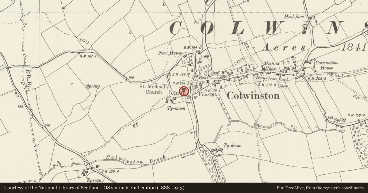
Slide toward Today to fade the historical sheet and see the modern map underneath.
David Rumsey Map Collection, Stanford LibrariesDavid Rumsey Map Collection, Stanford LibrariesDavid Rumsey Map Collection, Stanford LibrariesDavid Rumsey Map Collection, Stanford LibrariesDavid Rumsey Map Collection, Stanford Libraries
5 historical maps cover this location, the earliest the 1636 map "Cornubia : Devonia, Somersetus, Dorcestria, Wiltonia, Glocestria ..." (David Rumsey Map Collection, Stanford Libraries).
Historical maps covering this location
- 1636 · Cornubia : Devonia, Somersetus, Dorcestria, Wiltonia, Glocestria ... (David Rumsey Map Collection, Stanford Libraries)
- 1637 · The fourth table of England. Cornub. Devonia, Somerset etc. (David Rumsey Map Collection, Stanford Libraries)
- 1865 · England and Wales. England No. 6. (David Rumsey Map Collection, Stanford Libraries)
- 1897 · 262 Pontypridd (Hills) (David Rumsey Map Collection, Stanford Libraries)
- 1897 · 262 Pontypridd (Outline) (David Rumsey Map Collection, Stanford Libraries)
Cadw's description
Location
On the south side of the Church of St. Michael and All Angels near the porch.
History
Late medieval, possibly early C16 and contemporary with the tower etc. of the adjacent Church of St. Michael and All Angels (qv). It has an introduced cross-head which is possibly the original gable cross from the chancel.
Exterior
Churchyard Cross of white limestone which consists of a short polygonal shaft with cross-head in square socket on base of three square steps. The shaft has been truncated and the cross-head which appears to be of a different stone, probably comes from elsewhere (see History).
Reason for designation
Included as a partly medieval cross and for group value with the Church of St. Michael and All Angels.
Nearby in the register
- Church of St Michael and All AngelsReligious, Ritual and Funeraryunder 1 mi
- Churchyard Wall of Church of St. Michael and All AngelsReligious, Ritual and Funeraryunder 1 mi
- The Old ParsonageDomesticunder 1 mi
- Village HouseDomesticunder 1 mi
Other entries of the same register within about three miles of this one, by straight line.