Cof Cymru: National Historic Assets of Wales · Wales
Milepost on Bryncaerau
Trimsaran, Carmarthenshire, Wales
A Grade II listed building in Trimsaran, Carmarthenshire, designated on 23 July 2003.
The record
- Designation
- Listed building, Grade II
- Broad class
- No class recorded
- Date of designation
- 23 July 2003
- Locality
- Trimsaran
- Community
- Trimsaran
- Unitary authority
- Carmarthenshire
- Country
- Wales
- Coordinates
- 51.72425, -4.25452
- Cadw reference
- 81325
Slide toward Today to fade the historical sheet and see the modern map underneath.
David Rumsey Map Collection, Stanford LibrariesDavid Rumsey Map Collection, Stanford LibrariesDavid Rumsey Map Collection, Stanford LibrariesDavid Rumsey Map Collection, Stanford LibrariesDavid Rumsey Map Collection, Stanford Libraries
5 historical maps cover this location, the earliest the 1636 map "Cornubia : Devonia, Somersetus, Dorcestria, Wiltonia, Glocestria ..." (David Rumsey Map Collection, Stanford Libraries).
Historical maps covering this location
- 1636 · Cornubia : Devonia, Somersetus, Dorcestria, Wiltonia, Glocestria ... (David Rumsey Map Collection, Stanford Libraries)
- 1637 · The fourth table of England. Cornub. Devonia, Somerset etc. (David Rumsey Map Collection, Stanford Libraries)
- 1891 · Sheet 10. Ordnance Survey of England and Wales. . (David Rumsey Map Collection, Stanford Libraries)
- 1898 · 229 Carmarthen (Hills) (David Rumsey Map Collection, Stanford Libraries)
- 1920 · Sheet 100. Llanelly. (David Rumsey Map Collection, Stanford Libraries)
Cadw's description
Location
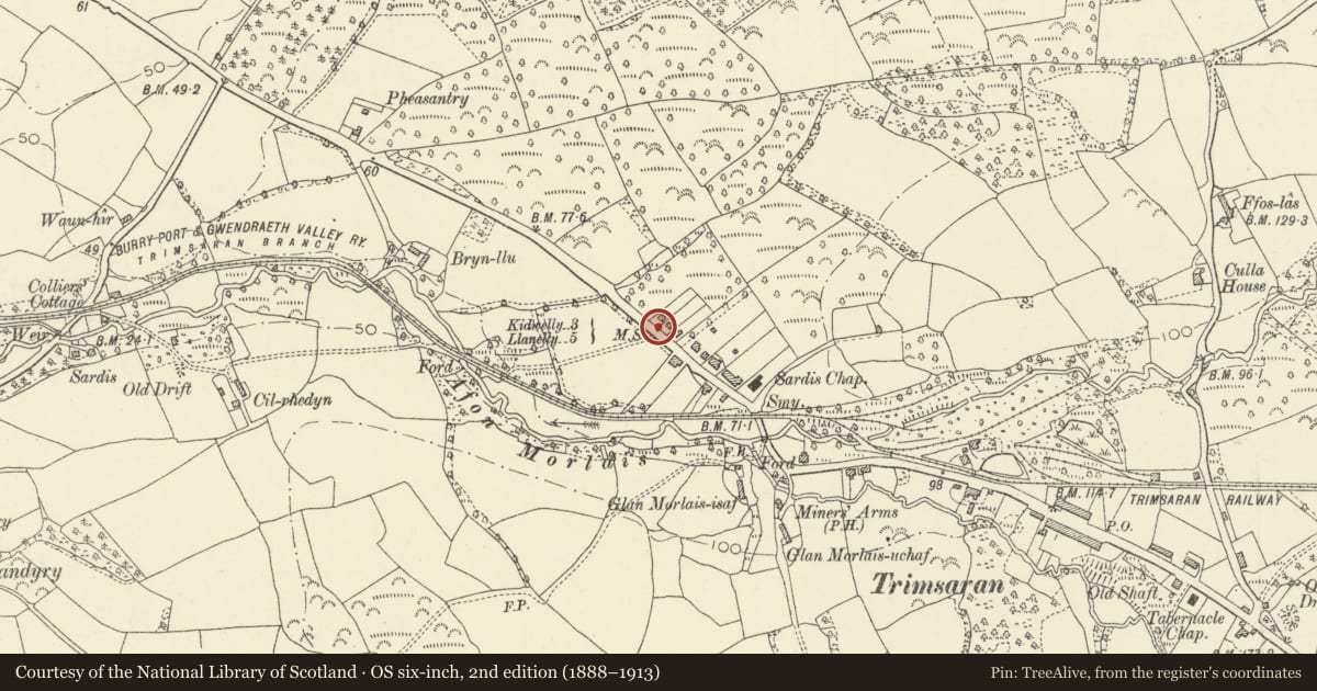
Approximately 150m NW of Sardis Chapel.
History
A late C19 milepost, one of a series on the Llanelly to Kidwelly road cast by Glanmor Foundry Company of Llanelli (name on plinth), and shown on the 2nd edition Ordnance Survey.
Exterior
A V-shaped cast iron milepost with ramped top, painted white, on a square plinth. It reads, in raised letters and numerals painted black, 'To Llanelly 5 miles' on one face, and on the other 'To Kidwelly 3 miles' and 'To Carmarthen 12'.
Reason for designation
Listed for its special interest as one of a series of well-preserved mileposts on the B4308.
Nearby in the register
- Llandyry ChurchReligious, Ritual and Funeraryunder 1 mi
- Bridge at Moat FarmTransportunder 1 mi
- Pont Spwdwr (Spudder's Bridge)Transportunder 1 mi
- Spudder's BridgeBridgeunder 1 mi
Other entries of the same register within about three miles of this one, by straight line.